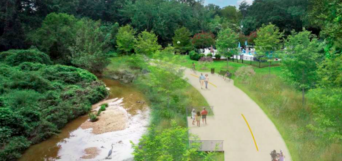
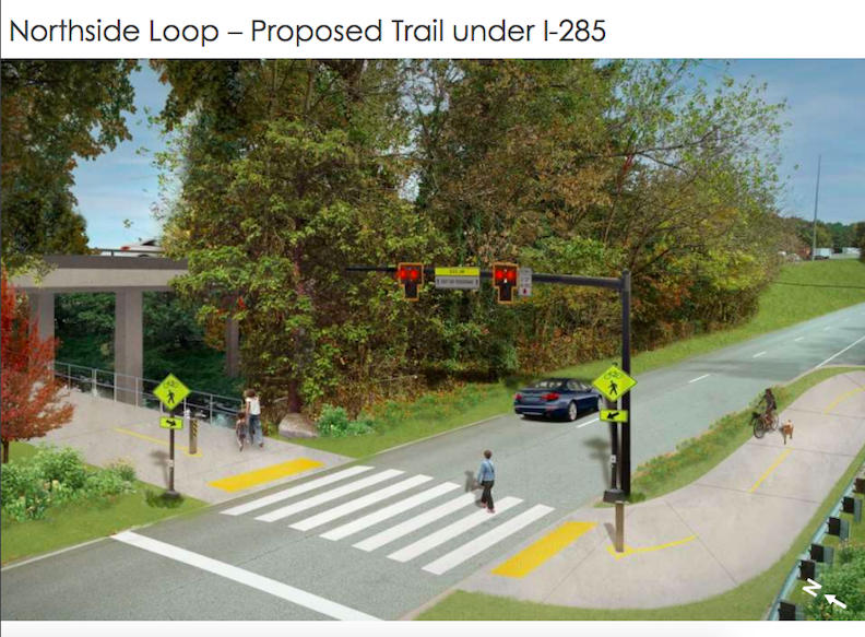
Chamblee’s years-long quest to blanket the city in a network of multi-use trails—including a BeltLine-like loop at the city’s northern end—continues to take steps toward becoming reality.
Months of organizational sessions and community meetings between October and early February have resulted in a Chamblee Trails Master Plan recently unveiled by the PATH Foundation and Kaizen Collaborative.
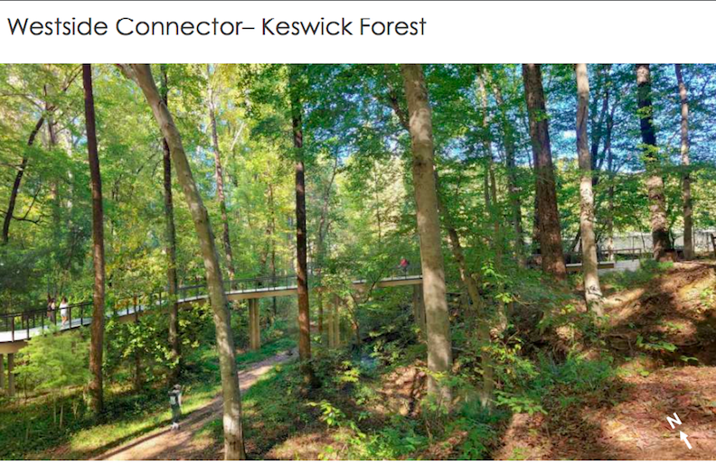
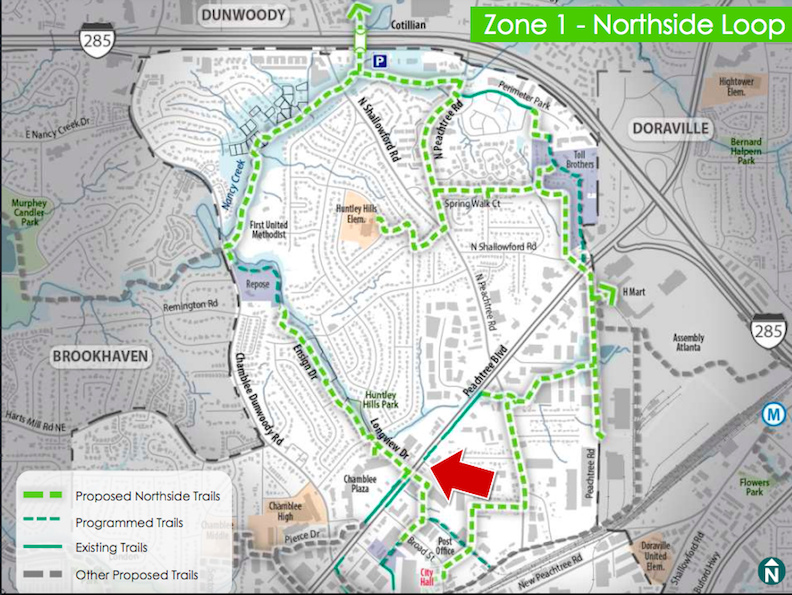
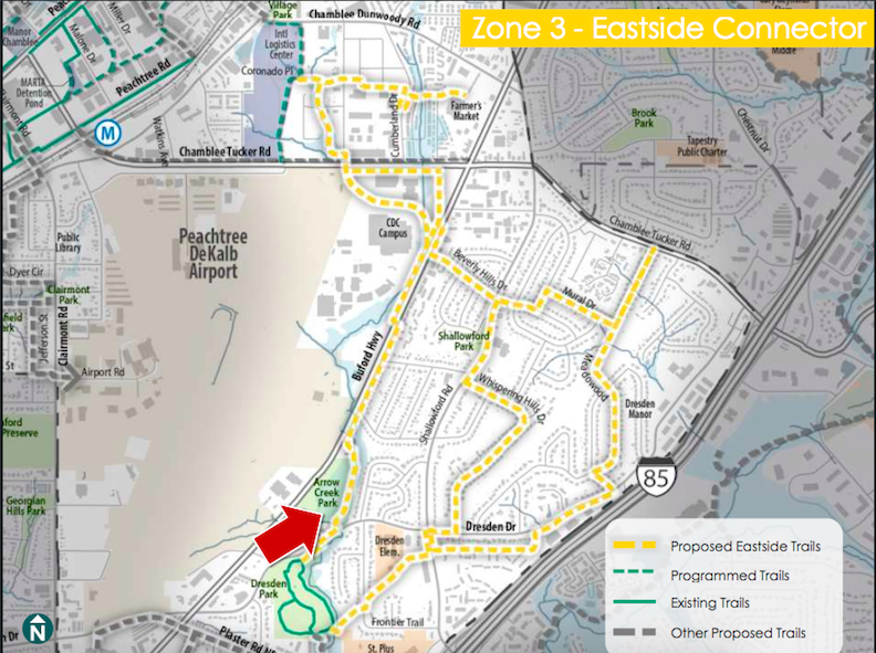
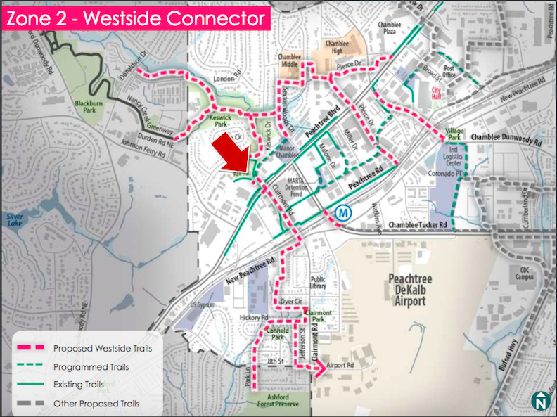
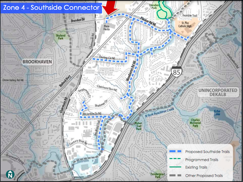
Plans are broken down into four “zones,” or specific segments: A Northside Loop, and Westside, Southside, and Eastside connectors.
A web of PATH trails would link to existing Chamblee trails and key landmarks such as parks, schools, and MARTA stations.
Creeks in the north ITP area, an H Mart, a CDC campus, a large Toll Brothers development, a farmers market, and the massive Assembly Atlanta project would also be looped in. As an added bonus, Plaza Fiesta—a former 1960s shopping mall turned Latin American cultural center and foodie destination—would have direct frontage on the PATH network as well, should current plans come to fruition.
The trail network’s name and branding are still TBD. Suggestions from recent meetings include “Chamblink” or “Chamblinx,” the “Chamblee Rail Trail,” or the “Rail Trail Connector.”
The next step in the trails planning process is to approve a draft master plan. A steering committee meeting is scheduled February 23, followed by a Chamblee City Council work session in March.
If all goes well, PATH Foundation leaders expect the city to adopt the plans in April. A model project trail segment would be built first.
Eventually, plans call for linking Chamblee trails at the southernmost tip with the Peachtree Creek Greenway’s north fork in Brookhaven—and by extension, the PATH400 trail in Buckhead, and the Atlanta BeltLine beyond.
Head up to the gallery for a quick, rendering-filled tour of where Chamblee trail plans stand—no helmet required.
First, here’s a detailed look at each proposed trail zone:
...
Follow us on social media:
• Chamblee news, discussion (Urbanize Atlanta)


