The agency building a long-awaited, protected trail connection between several eastside neighborhoods and the BeltLine has shed some light on what Atlantans can expect in coming months as construction unfolds.
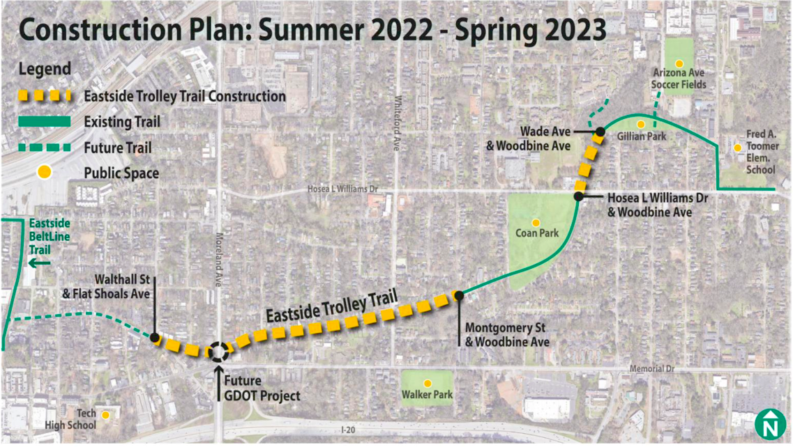
As part of its August newsletter, PATH Foundation distributed an updated map and a rendering showing how the Eastside Trolley Trail will be implemented soon—and what will remain on the drawing board as a future phase that’s recently secured funding.
PATH Foundation broke ground in early July to extend the existing trail from Gilliam Park in Kirkwood to Flat Shoals Avenue in Reynoldstown. Doing so would bring to fruition PATH Foundation plans that have been percolating for nearly 30 years.
A revised map indicates construction will take place between this summer and next spring. In the newsletter, however, PATH Foundation heads say the trail will be completed and open for the public next fall.
Initial construction efforts will focus on the area between Hosea Williams Drive and Gilliam Park in Kirkwood, where silt fencing and tree-protection measures have been installed, as PATH Foundation officials told Urbanize Atlanta last month.
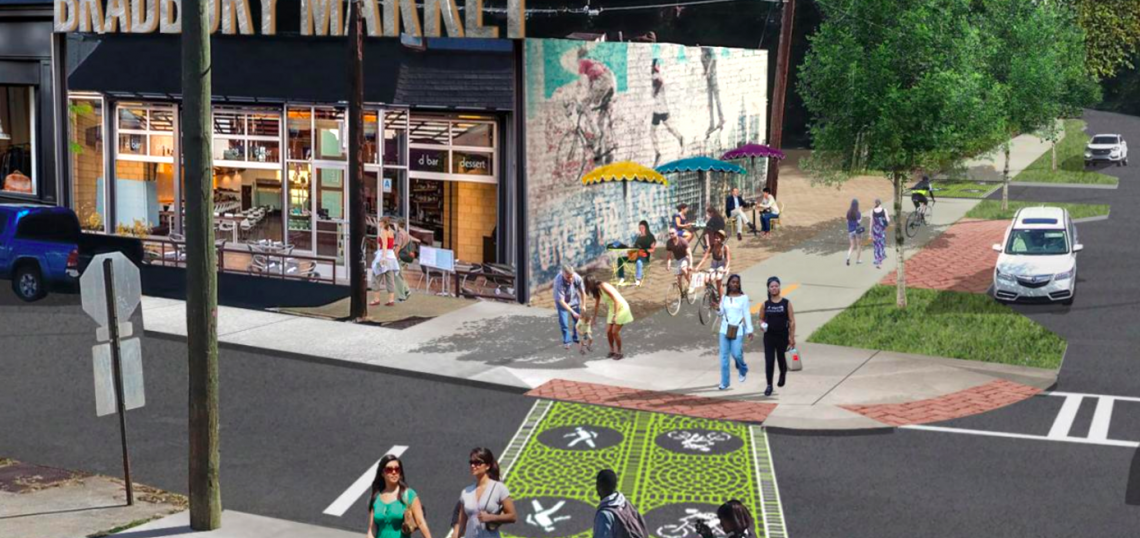
The new map isn’t so detailed to show exactly how the trail will be implemented in places like Edgewood (our questions on the topic have previously gone unanswered), but the latest rendering does give an idea how it could navigate a potential sticking point at popular taqueria El Tesoro, where crowds frequently line the existing sidewalk.
 A rendering showing how the PATH Foundation plans to finish the Eastside Trolley Trail at Arkwright Place and Whitefoord Avenue in Edgewood. Popular taqueria El Tesoro is located at bottom left. PATH Foundation
A small gap around Moreland Avenue will remain until it's included in a Georgia Department of Transportation project where Arkwright Place meets the busy corridor, according to PATH.
GDOT plans to install a dedicated signal for pedestrians and cyclists at Moreland Avenue, officials have said.
A short trail connection between Gilliam Park and Arizona Avenue is also now listed as a future trail segment and not part of the current scope, per the new map. A mulch path and concrete lot exist in that area today.
 A map from three years ago showing the scope of Eastside Trolley Trail construction, along with potential future links toward other trails. PATH Foundation
Construction of the forthcoming Eastside Trolley Trail segment will cost $1.98 million, as funded by donors and TSPLOST dollars approved by Atlanta voters in 2016.
The more recent passage of the $750 million “Moving Atlanta Forward” infrastructure and bond measure—overwhelmingly approved by Atlanta voters in May—will provide funding for the Eastside Trolley Trail’s next phase. PATH officials say that funding allows them to now start planning for the pathway “to connect to the BeltLine and two additional spur trail connections.”
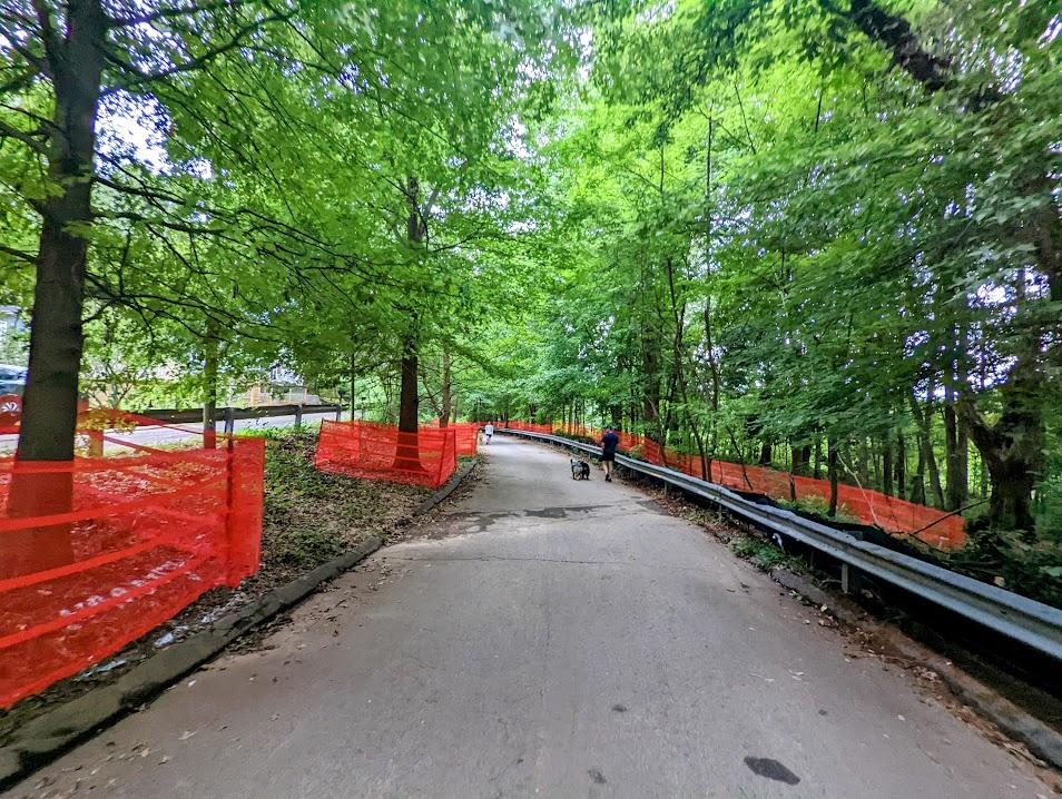 Heading south toward Coan Park, construction fencing lines both sides of Woodbine Avenue. Work in the area has paused in recent weeks. Josh Green/Urbanize Atlanta
Excellere Construction crews began work last month on the project that promises to more safely usher Atlantans in eastside neighborhoods south of DeKalb Avenue to the BeltLine and back.
For anyone coming from the BeltLine, the Eastside Trolley Trail will start on-street in Reynoldstown near the Eastside Trail, run eastward through Edgewood, and connect with existing PATH sections that were installed prior to the 1996 Olympics as the project's first phase. The finished project will provide a nearly two-mile route for non-drivers from the doorstep of Kirkwood’s downtown back to the BeltLine.
Eventually, the Eastside Trolley Trail could extend into Decatur, PATH officials have said. Its name is a nod to the historic Atlanta-Decatur trolley car line that once snaked through eastside streets between Cabbagetown and Agnes Scott College.
• Taxpayers pass Moving Atlanta Forward package. Now let's build some sh*t (Urbanize Atlanta)