A key component of PATH400 that could stand as a highlight for multi-use trail enthusiasts across metro Atlanta has nearly finished its complex, yearlong installation.
C.W. Matthews Contracting Company is putting the finishing touches on the Mountain Way Common bridge, a trail structure that soars nearly 60 feet high between Ga. Highway 400 and towering trees.
The bridge is further proof the expansion of the existing, 12-foot-wide PATH400 trail north to Loridans Drive is coming together. Only the gap between Loridans Drive up to Atlanta city limits at Sandy Springs remains to be built; beyond that, Sandy Springs has approved a $20.1 million construction contract to extend the pathway past Interstate 285 into Central Perimeter.
Handrails to complete the Mountain Way Common bridge are being fabricated offsite and should be installed with two weeks, allowing construction crews to focus on the Loridans Drive section of the trail to the north, according to an update from Denise Starling, Livable Buckhead executive director.
 The Mountain Way Common bridge structure awaiting concrete recently—from 60 feet above the ground. Livable Buckhead/PATH400
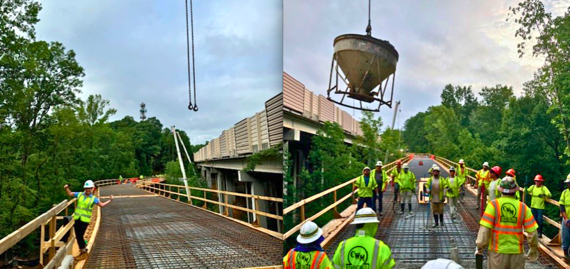
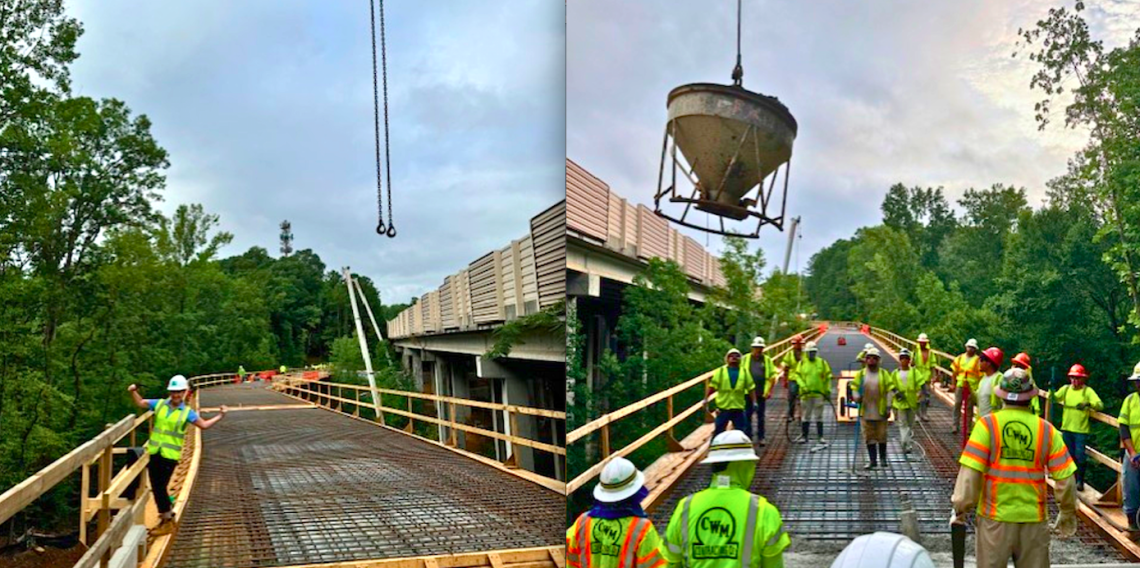
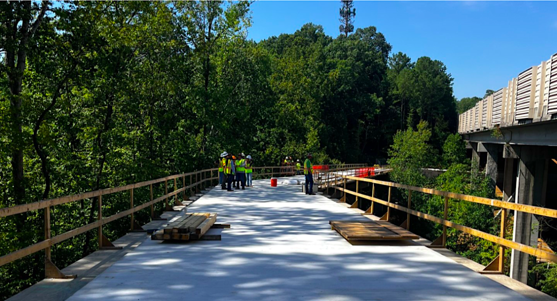 Fresh concrete installed atop the elevated PATH400 bridge. Livable Buckhead/PATH400
The height and scope of the PATH400 project echoes another bridge that’s being installed as part of the Atlanta Beltline’s Southside Trail construction over Ormewood Avenue, though the latter bridge stands about 20 feet shorter.
Both are proof the infamous “glorified sidewalk” description for Atlanta multi-use pathways remains woefully off-base.
Livable Buckhead is hosting a PATH400 construction tour near the new bridge at 10 a.m. Saturday, but registration spots are extremely limited as of this writing. (The agency is also hosting an online trivia game that asks how many pounds the Mountain Way Common bridge’s concrete actually weighs, with the closest guess garnering the winner a free GoBuckheadATL card.)
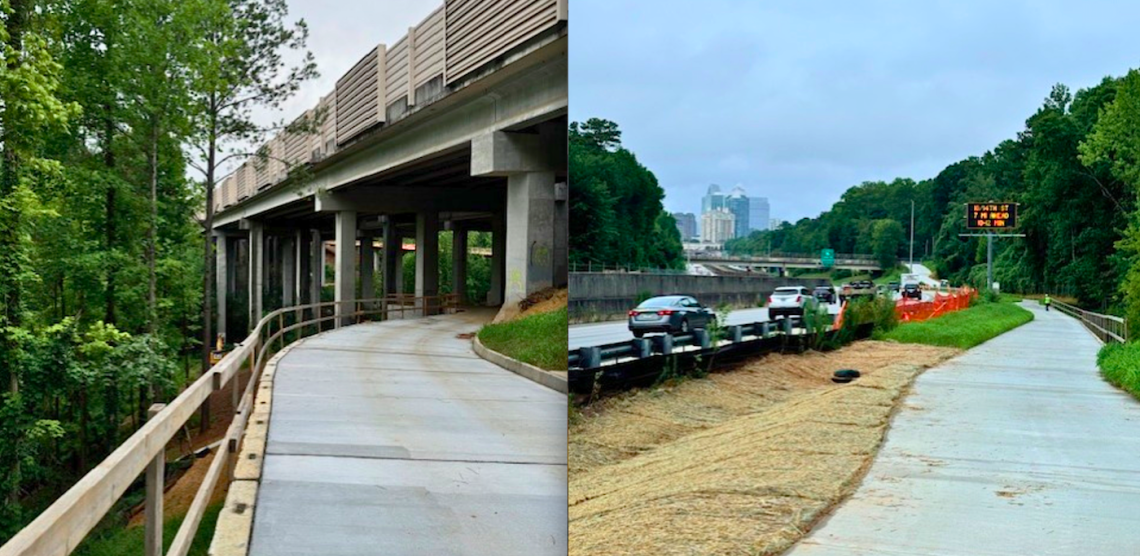 Construction progress on the next northward leg of PATH400 near Mountain Way Common (left) and looking south into central Buckhead (right). Livable Buckhead/PATH400
Plans are also moving forward to install a large, bold, artistic gateway to the trail at a key entry point: the top section of Miami Circle off Piedmont Road, home to the Southeast’s largest collection of art galleries and attractions such as Eclipse di Luna restaurant. As is, PATH400 links to a parking lot next to Eclipse di Luna by way of a banal ramp.
Meanwhile, at the southernmost end of PATH400, a junction of trails is planned to help create a true regional network. Atlanta Beltline Inc. received a $25 million federal grant in summer 2023—the largest in project history—to help build those connections between the Beltline’s Northeast Trail, PATH400, and two other trail networks in the Lindbergh area, the Peachtree Creek Greenway, and Southfork Conservancy trails. Planning work continues in that area.
Schedules call for PATH400’s full, 5.2-mile greenway to be finished on public land adjacent to Ga. Highway 400 sometime in 2025. Partnering with Livable Buckhead on the project are the PATH Foundation and Buckhead Community Improvement District.
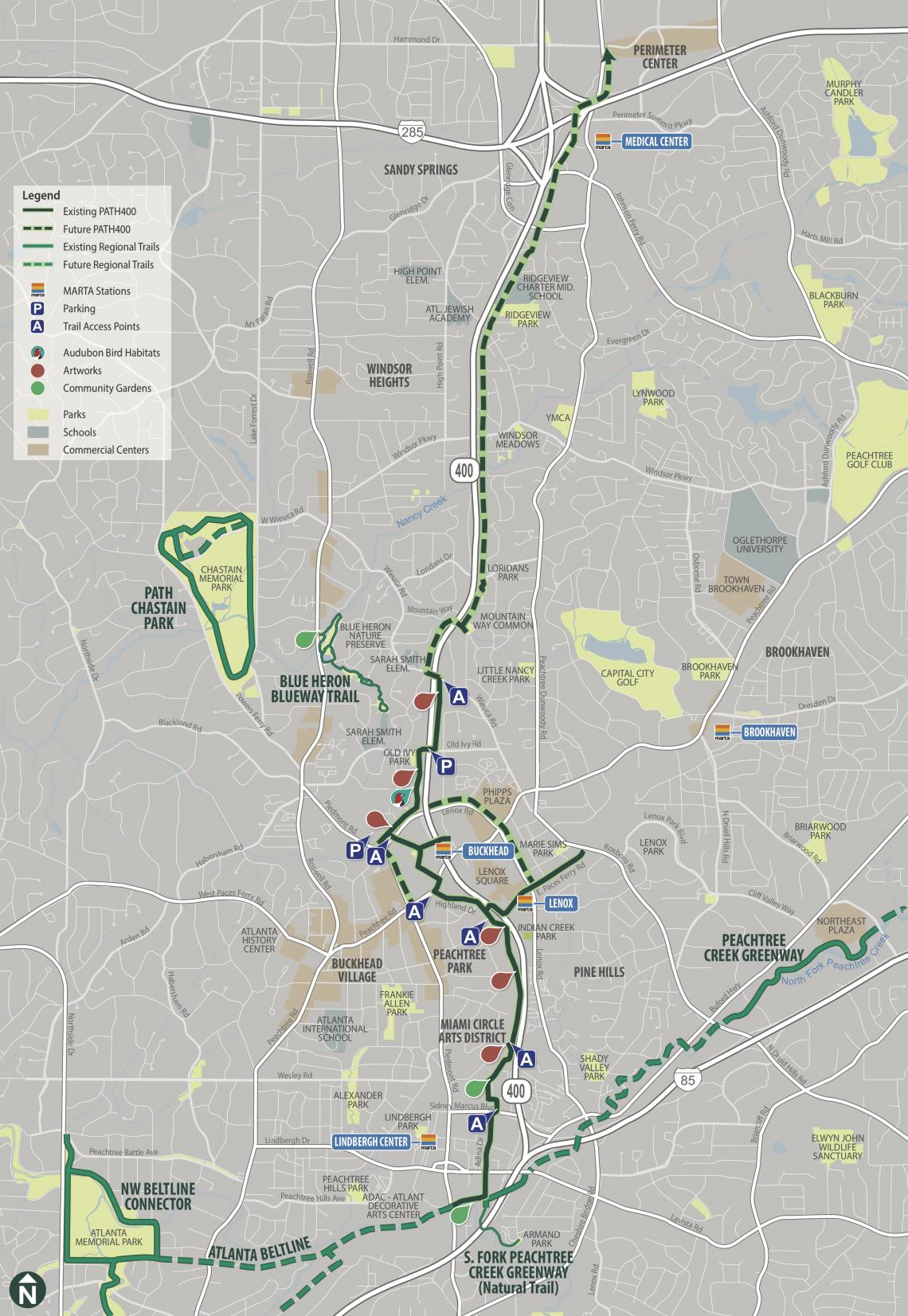 How PATH400 is expected to fit into a growing regional network of trails. The first dotted sections north of existing trails are under construction now. Livable Buckhead/PATH400; PATH Foundation
...
Follow us on social media:
Twitter / Facebook/and now: Instagram
• Buckhead news, discussion (Urbanize Atlanta)