One aesthetic highlight of Buckhead’s growing trail network is finally moving forward, several years after tentative concepts first emerged.
What’s more, artists from Atlanta and beyond will soon be called upon to make the project as Insta-worthy as possible.
The top section of Miami Circle off Piedmont Road—home to the Southeast’s largest collection of art galleries—will be transformed into a proper gateway for the PATH400 trail system, according to Denise Starling, Livable Buckhead executive director.
Today, PATH400 links to a parking lot next to Eclipse di Luna restaurant by way of an unremarkable ramp. Starling says Livable Buckhead plans to rebuild the ramp with a bold artistic feature as a means of linking public art on the trail with fine art in galleries.
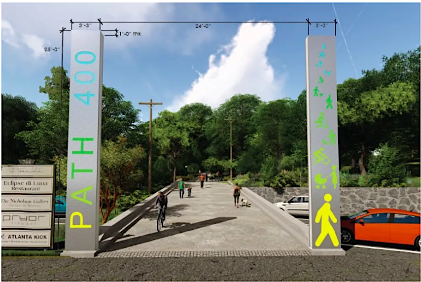 An artist rendering interpretation of what the gateway project could look like released circa 2019. Rendering by Perez Planning + Design; courtesy Livable Buckhead
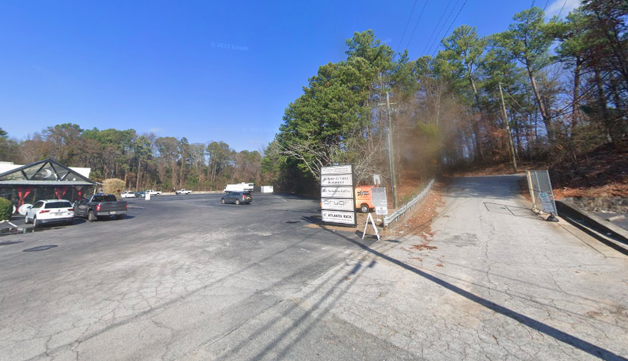 The area in question today, with Eclipse di Luna restaurant at left. Google Maps
A concept released about four years ago for illustrative purposes shows a PATH400-branded metal entryway standing 25 feet tall, but what’s actually built could be wildly different.
“We don’t really know what to expect but are hoping to see some really cool ideas,” Starling tells Urbanize Atlanta. “This gateway needs to be awesome.”
Starling says an ETA for a call to artists and groundbreaking hasn’t been determined, as Livable Buckhead is “going into the legislative and procurement processes for the city, which are a little unpredictable.”
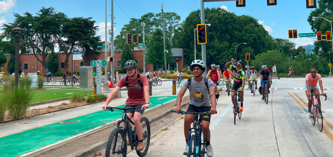
The PATH400 segment in question was opened in 2021 as a link between two Buckhead shopping, working, and dining nodes—Miami Circle and the Lenox area. It signaled this northern, multi-purpose cousin of the Atlanta BeltLine, which is planned to eventually stretch 5.2 miles, was about 80 percent finished at the time.
But that’s changing, too.
Starling reports that construction to expand the existing PATH400 trail north to Loridans Drive has hit its stride this summer. Several walls have been erected and infrastructure for PATH400 bridges that soars nearly 60 feet is nearly finished.
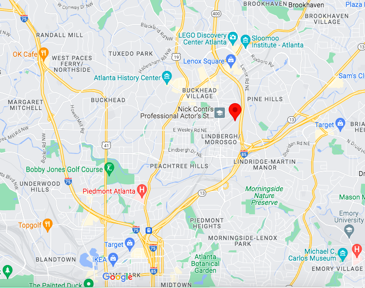 The PATH400 gateway location north of Interstate 85. Google Maps
Beyond that, the City of Atlanta’s Department of Transportation is working through legislation and paperwork to begin the next and last PATH400 leg, stretching from Loridans Drive up to a point near the border of Sandy Springs, according to Livable Buckhead.
Sterling says that project is on pace to be advertised sometime in the third quarter of this year—and that the final major section of PATH400 could be under construction as soon as early 2024.
The outlook is brighter on the opposite end of PATH400 as well. Earlier this summer, Atlanta BeltLine Inc. received a $25 million federal grant—the largest in project history—to help build connections between the BeltLine, PATH400, and two other trail networks in the Lindbergh area, the Peachtree Creek Greenway, and Southfork Conservancy trails.
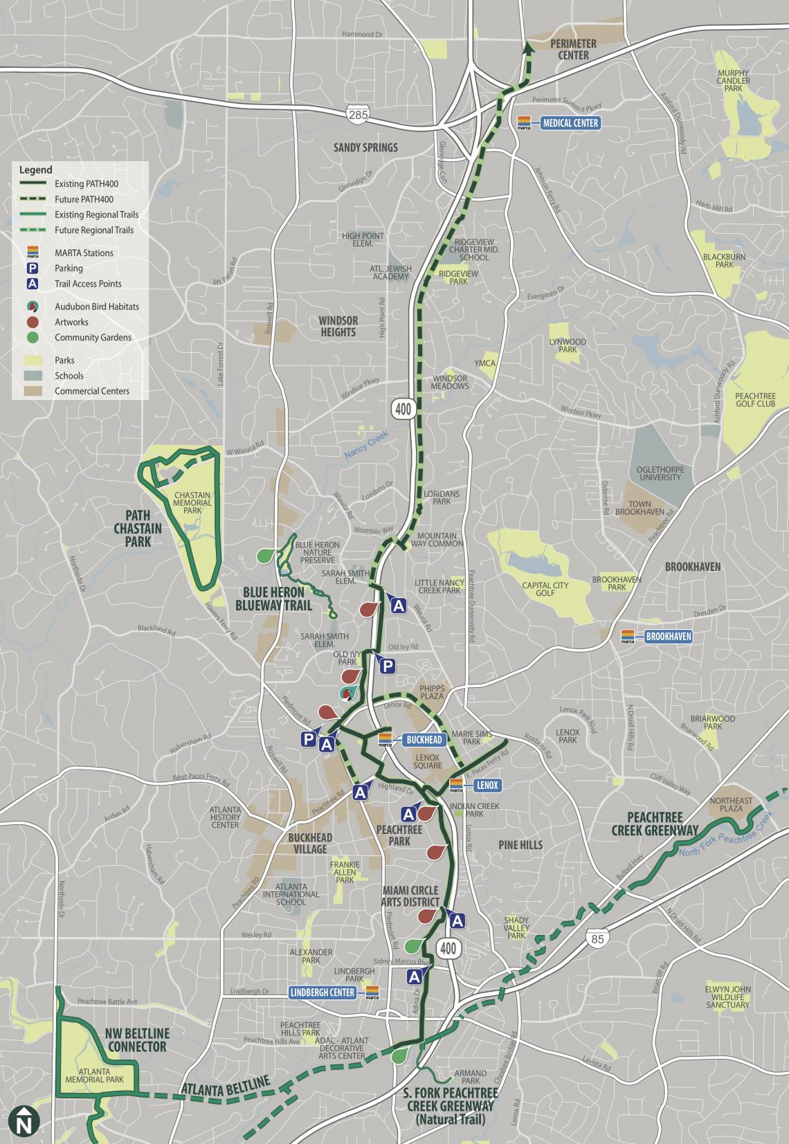 How PATH400 is expected to fit into a growing regional network of trails. The first dotted sections north of existing trails are under construction now. Livable Buckhead/PATH400; PATH Foundation
...
Follow us on social media:
• Buckhead news, discussion (Urbanize Atlanta)