Let’s say you live in Chosewood Park, Grant Park, or Reynoldstown. Your company moves its offices to the burgeoning employment hub that is Central Perimeter. Your boss declares WFH over, and MARTA, for whatever reason, won’t work for you. You’re doomed to the commute from hell, right?
Not necessarily. At least not for long. Potentially.
If you’re new to Atlanta’s urbanism scene (or the city overall), all this talk of Northeast Trail construction and PATH400 extensions and the Peachtree Creek Greenway could make your eyes go crossed. But as part of its periodic PATH400 construction updates, Livable Buckhead issued an updated map today that could help. It provides a broad outlook on what the future could/should hold in terms of trail connectivity across Atlanta’s northern reaches—and by extension, the rest of Georgia’s capital city and its growing, neighboring municipalities to the north.
Should all these Livable Buckhead and PATH Foundation plans come to fruition—alongside current BeltLine timelines—riding an e-bike, or a motorized scooter, or a good-old pedal bike from, say, an Adair Park bungalow to jobs at Dunwoody’s High Street mini-city would be totally feasible in less than five years. It’d also be a quicker commute, at certain times of day, and vastly cheaper overall.
Let’s start from the top, in Sandy Springs, where a multi-use trail connection is planned as part of the ongoing Ga. Highway 400/Interstate 400 overhaul.
That infrastructure is expected to dip down and connect with PATH400, which is Buckhead’s 5.2-mile answer to the BeltLine. That trail is more than 80 percent finished today.
The next PATH400 leg, as Livable Buckhead executive director Denise Starling reports, is expected to see construction crews mobilizing on site in coming days. That hilly section, stretching from Wieuca Road down to Loridans Park, is scheduled to open sometime next year.
From there, PATH400 stretches for several miles through central Buckhead down to a crucial connection point, meeting a new trail network installed by PATH Foundation and South Fork Conservancy in 2021. (Plans call for that to eventually shoot off toward other new trails in Brookhaven and, one day, Chamblee.)
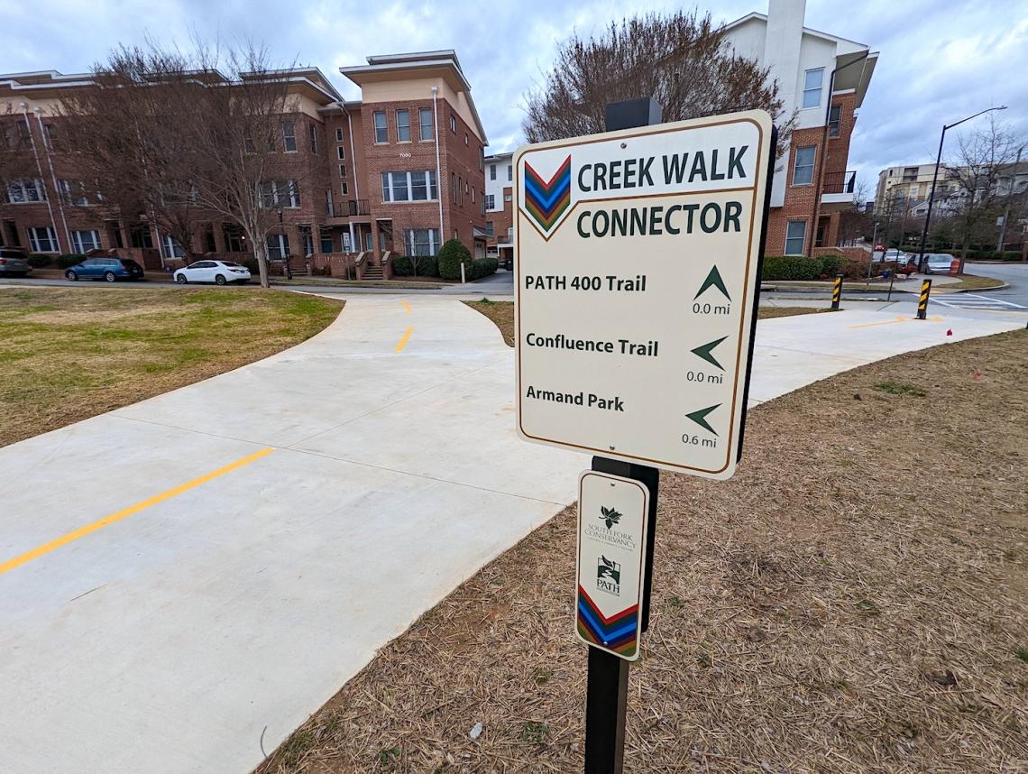 Wayfinding signage installed at the point where three trail segments converge today, a couple of blocks east of Piedmont Road, along Adina Drive. The Home Depot near Lindbergh is about three blocks north of here. Josh Green/Urbanize Atlanta
Just to the west of that point, the BeltLine is under construction on the next section of the Northeast Trail, linking Piedmont Park up to the Lindbergh area. That’s expected to open this fall, though a short gap between its northern end and PATH400 will remain.
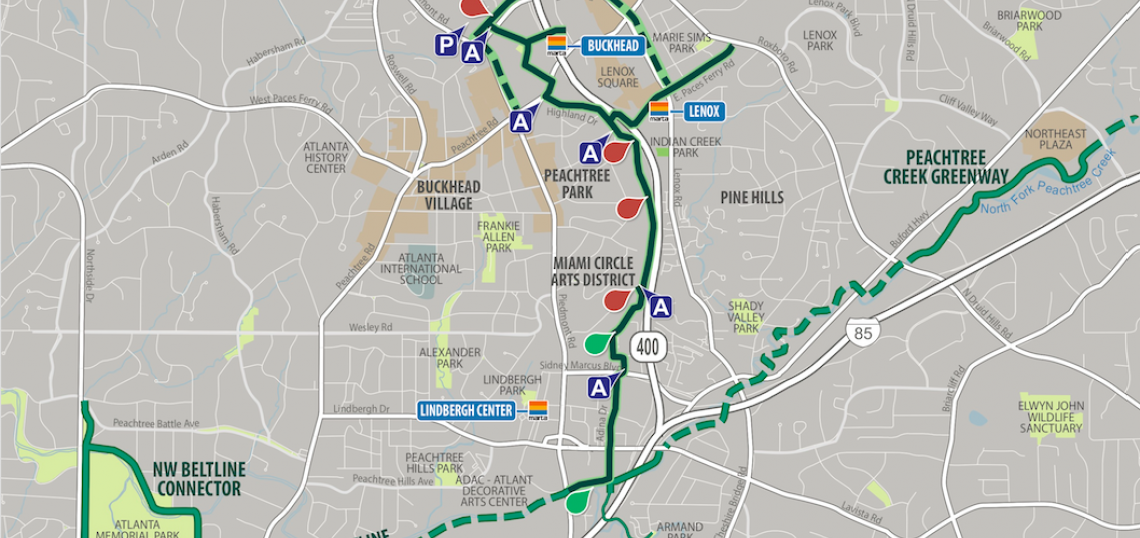
If absolutely none of that makes sense, here’s the full picture of what the future could hold in coming years, should all this glorious off-street connectivity come together as planned:
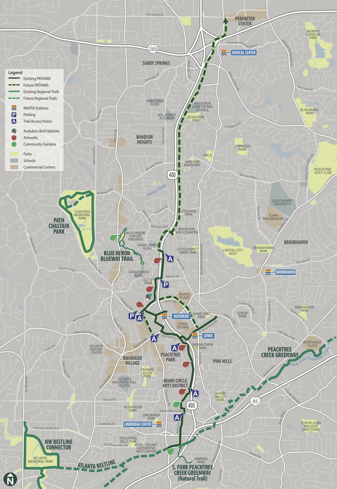 How PATH400 is expected to fit into a growing regional network of trails. The first dotted sections north of existing trails are under construction now. Livable Buckhead/PATH400; PATH Foundation
...
Follow us on social media:
• Buckhead news, discussion (Urbanize Atlanta)