Buckhead’s version of the BeltLine—albeit more of a straight line than a loop of multi-use trails—is set to start growing again.
Livable Buckhead officials say the long-planned northern push of the PATH400 trail between Wieuca Road and Loridans Drive is set to officially break ground November 10. Atlanta Mayor Andre Dickens is scheduled to help lead groundbreaking ceremonies that afternoon.
Partially funded by the Georgia Department of Transportation, the next PATH400 leg is a complex, hilly section that will snake under Ga. Highway 400, to the west side of traffic lanes, before switching back to the eastern side and heading north.
Project designs wrapped up earlier this year, followed by a procurement stage with the City of Atlanta to pick a contractor. The stretch of trail is critical for linking Buckhead neighborhoods together—and eventually tying PATH400 into similar trail initiatives underway in northern neighbor Sandy Springs.
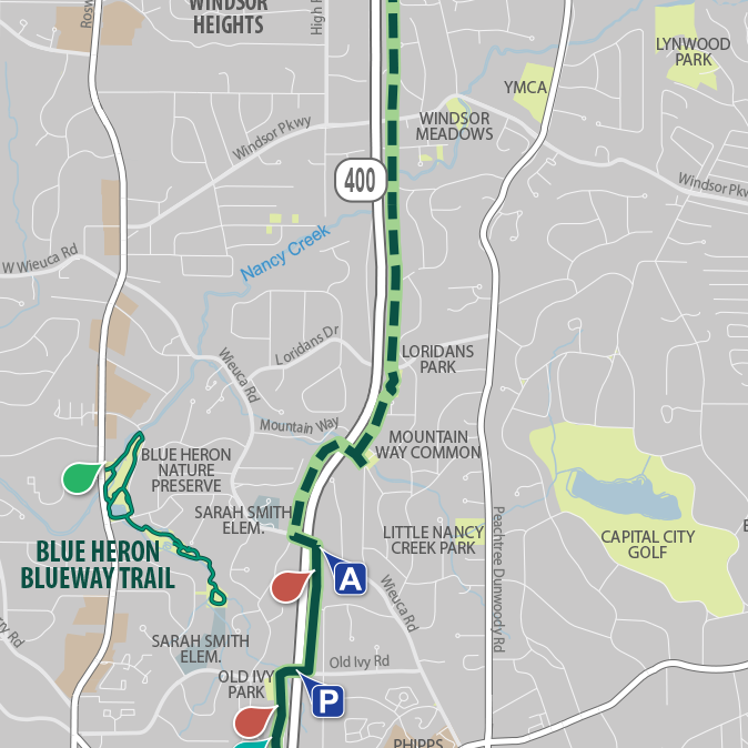 The PATH400 section from Wieuca Road to Loridans Park is planned next. North of that, PATH400 leaders are working with Sandy Springs to construct the trail. PATH400/Livable Buckhead
Denise Starling, Livable Buckhead executive director, has said construction should take between a year and 18 months, based on prior PATH400 phases. Nearby, the Mountain Way Common greenspace is expected to be used heavily for construction staging, and Mountain Drive could be closed at some point.
Livable Buckhead has been spearheading the five-mile greenway project since its inception, with help from the PATH Foundation and Buckhead Community Improvement District. The goal is to link residential areas with offices, parks, and retail hubs throughout Buckhead and beyond.
PATH400 opened its first segment about eight years ago, offering an off-street connection between Old Ivy Road and Tower Place, and a BeltLine-style exercise and transportation option for north ITP dwellers.
Now, the 5.2-mile planned trail is more than 80 percent finished.
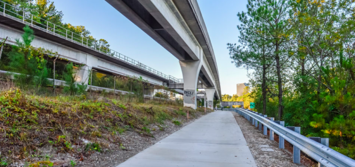
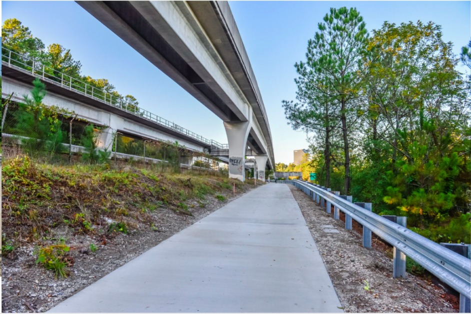 Passing under MARTA tracks, the PATH400 section from Miami Circle to the Lenox Square area opened in 2021. PATH 400/Livable Buckhead
The lone remaining stretch on the north end would take PATH400 from the new Loridans Park greenspace initiative up to Atlanta city limits.
There, Sandy Springs is working to bring PATH400 up the Ga. Highway 400 corridor into the growing Perimeter city, extending the trail another 2.3 miles north.
The goal is to bring PATH400 from Loridans Drive to Johnson Ferry Road, outside City of Atlanta limits. Once in Sandy Springs, the trail would tie into the ongoing overhaul of Ga. Highway 400’s interchange with Interstate 285, where a multi-use trail component has long been planned.
Implementing those plans would ultimately create a multi-use recreation and commuting option between Sandy Springs and the BeltLine’s 22-mile loop—and vice versa—with PATH400 acting as the connective link through Buckhead in between.
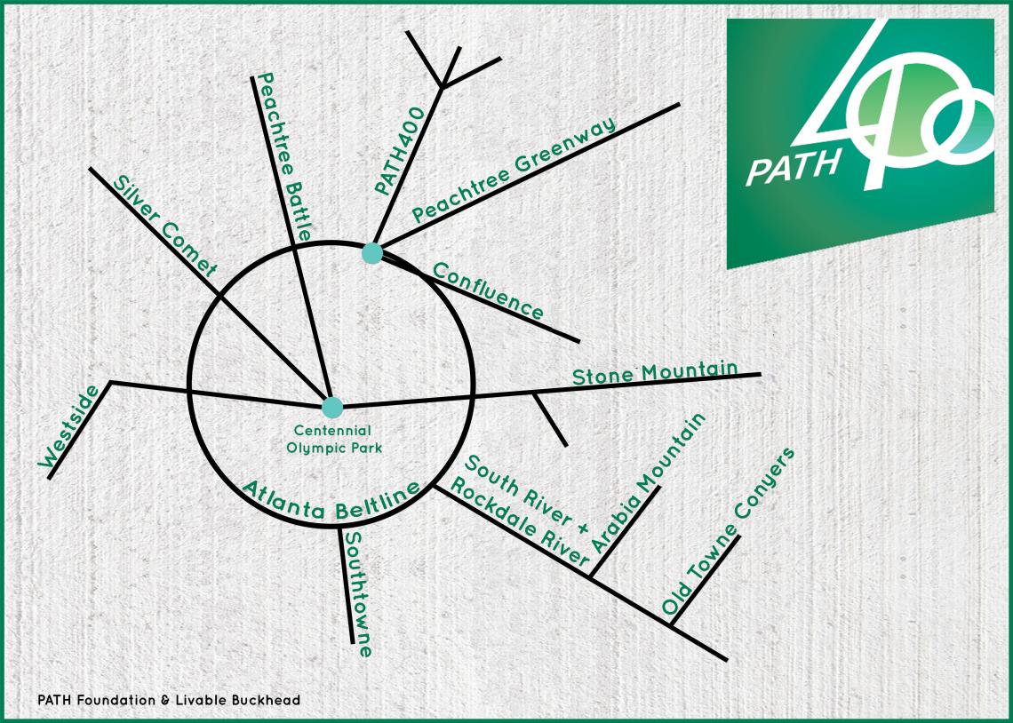 How PATH400 would be configured in a regional multi-use trail network. PATH400/Livable Buckhead/PATH Foundation
• Buckhead news, discussion (Urbanize Atlanta)