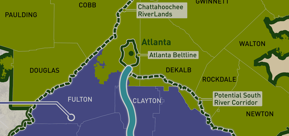
The metropolitan area that created the Atlanta Beltline is putting together plans for an even longer trail system south of downtown that showcases one of Georgia’s longest—but underutilized and underappreciated—rivers.
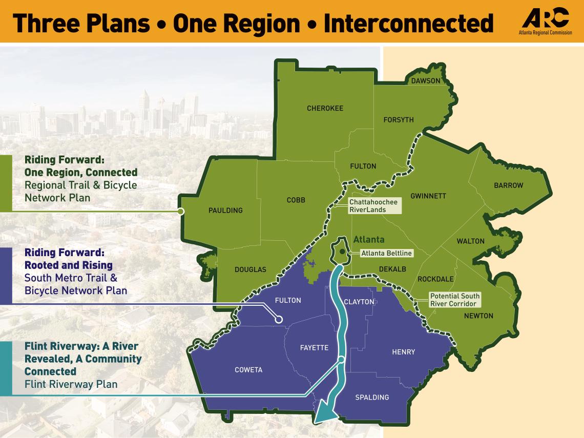
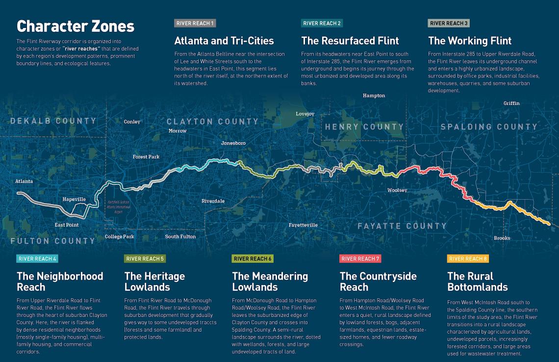
The Atlanta Regional Commission this month organized three "Flint Week" events as a means of spotlighting and drumming up momentum for the Flint Riverway project. It’s an ambitious, 40-mile multi-use trail concept that would branch off the Beltline near the Lee + White district and then link together neighborhoods and south metro counties.
Another objective, per ARC officials, is to spur economic growth, provide fresh recreation opportunities, and activate the Flint River itself.
Flint Week included a river cleanup in Jonesboro along with block parties in Hapeville and Jonesboro aimed at highlighting the Flint Riverway concept, maps, and the route planning outlook while gathering community feedback.
 Courtesy of Atlanta Regional Commission
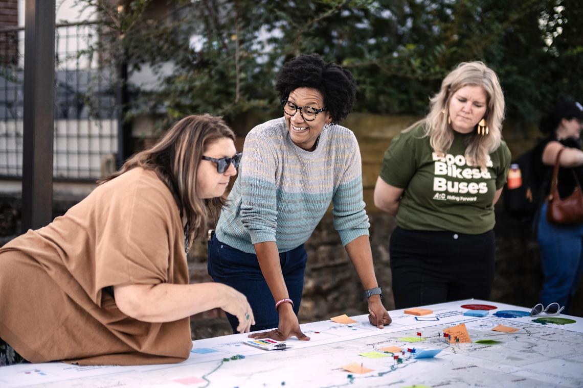 A Hapeville block party this month, held as part of Flint Week, was attended by College Park Mayor Bianca Motley Broom (center) and other officials. Courtesy of Atlanta Regional Commission
The concept last year lost tens of millions in federal funding that would have covered construction of two segments and broader engineering and planning work, but that setback wasn’t a death knell for the project, per ARC officials.
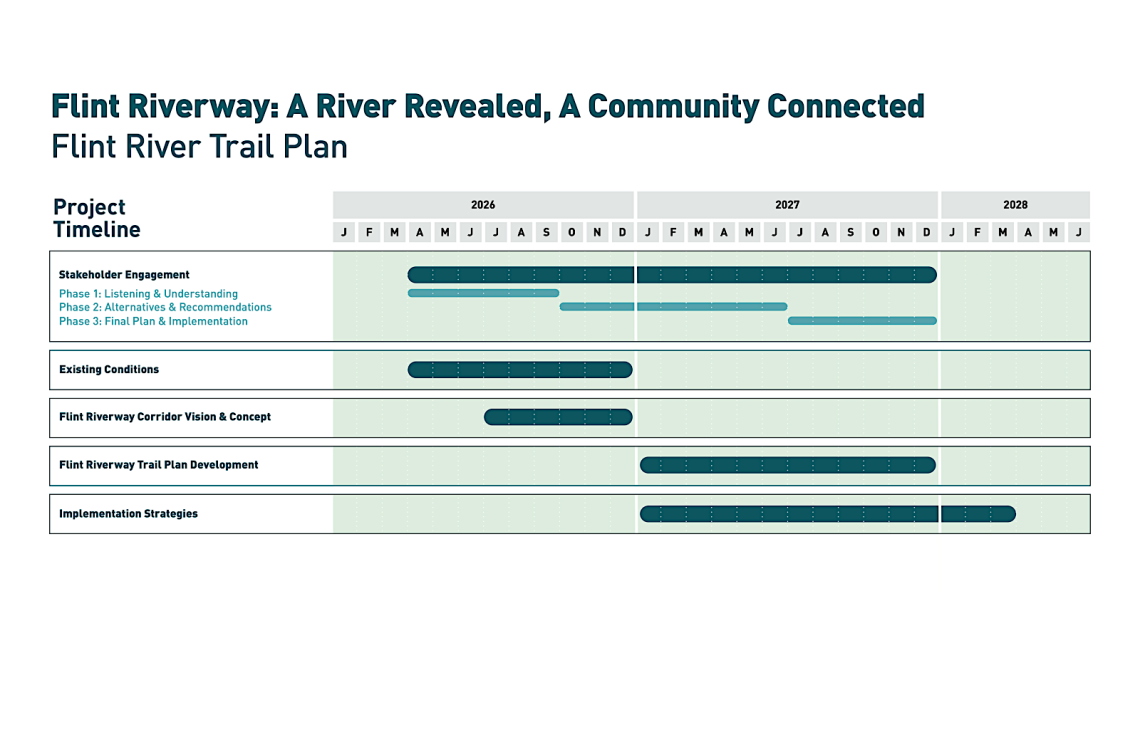
ARC is planning a public engagement phase and other studies through the end of 2027 to cover South Fulton, Clayton, Fayette, and Spalding counties.
Paul Donsky, ARC spokesperson, said construction timetables and cost estimates for the Flint Riverway have yet to be nailed down, as there’s “much to determine in the planning process before we get there.”
The planning process for the 40-mile study area will weigh which segments should be prioritized for funding first, to be built within roughly a decade. The goal is to have plans formally adopted by ARC’s Board in the first half of 2028, per Donsky.
“Local governments have utilized federal transportation dollars to build out trails—it's all part of the federal transportation funding process, same as roads and bridges,” Donsky noted via email. “Projects that use federal dollars often require a local match and must be included in ARC's long-range transportation plan. [Multi-use] trail projects are often built in stages through this process.”
 Courtesy of Atlanta Regional Commission
For well over a decade, community groups such as Finding the Flint and Aerotropolis Atlanta Alliance have been putting plans together to unearth and showcase the river’s headwaters through a visioning process.
As Georgia’s second longest river, the Flint begins near the Atlanta airport, where it’s either obscured by culverts, hidden beneath runways, or fenced-off on airport property, before flowing more than 340 miles and joining the Chattahoochee River at the Florida line.
Below is an outlook on the Flint Riverway timeline and implementation plan, as it stands today:
 Courtesy of Atlanta Regional Commission
...
Follow us on social media:
Twitter / Facebook/and now: Instagram
• Friday fun bag: What will Atlanta look like in 10 years? (Urbanize Atlanta)