

As construction rolls out, designs have changed for a closely watched Complete Streets project that will link together several key attractions in southeast Atlanta, including the Beltline’s recently finished Southside Trail.
According to Atlanta Department of Transportation officials, public parking spaces that some neighbors pulled for have been added to finalized designs for the multi-modal South Boulevard Safe Street project through Grant Park, Chosewood Park, Boulevard Heights, and other neighborhoods.
ATLDOT officials informed Grant Park leadership on Friday that previous construction plans with no on-street parking have been revised “to reflect community feedback.”
The added parking spaces—technically called “parking stalls”—will be “safe and compliant with city standards and best practices,” per an ATLDOT email obtained by Urbanize Atlanta.
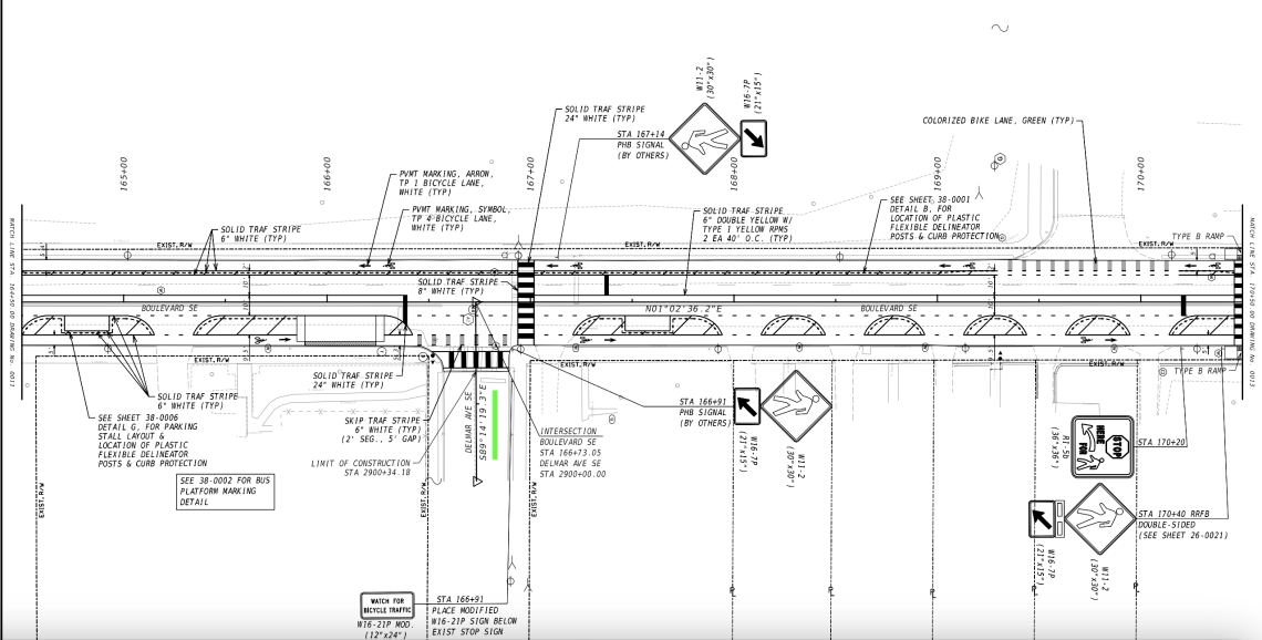 Plans for merging bike lanes with parking stalls (shown as rectangles) near Delmar Avenue (demarcated in green). ATLDOT; designs, Gresham Smith; Platinum Geomatics
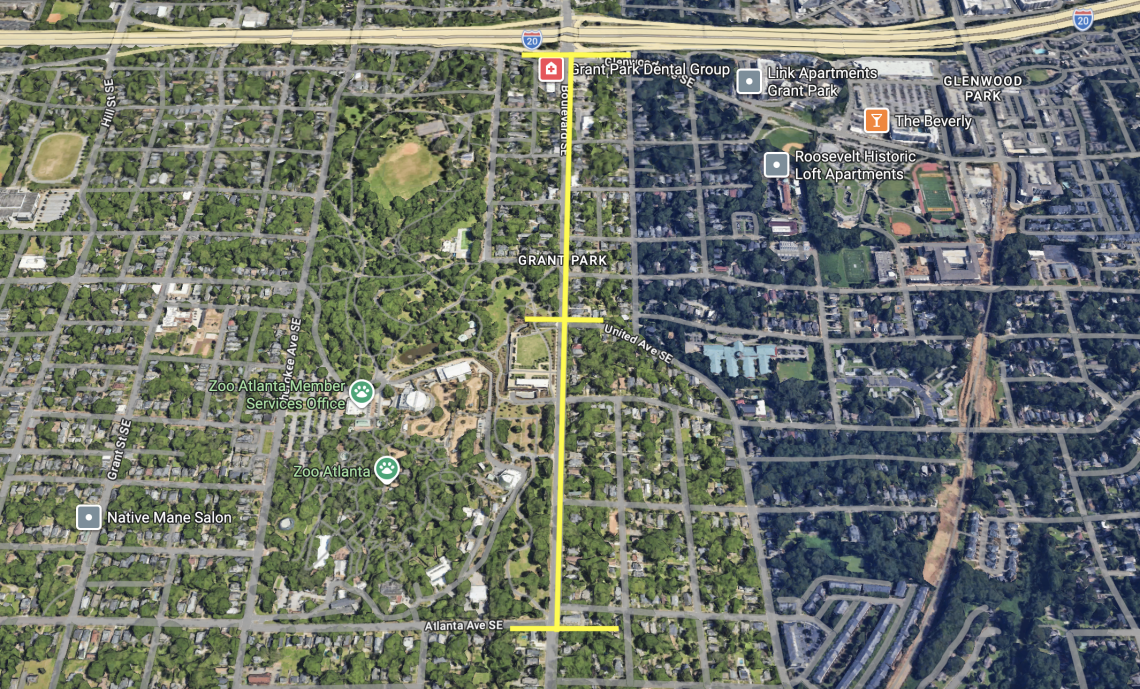 Looking north along Boulevard, the extent of where parking stalls are planned between Atlanta and United avenues, with Glenwood Avenue and Interstate 20 shown at top. Google Maps
Designs show that roughly 17 parking stalls will be added between Atlanta Avenue, just south of Zoo Atlanta, and United Avenue, where the Grant Park Gateway (and its eternally empty retail structure) is located.
The positive news for non-drivers is the parking stalls will be added between protected bike lanes and car traffic, essentially acting as a buffer between non-motorists and moving vehicles.
According to ATLDOT, the $9.1-million project officially went under construction last month and is now scheduled to finish in June next year. (Prior to design changes, earlier timelines had called for wrapping the project in September.)
The Complete Streets project covers 2.4 miles overall. According to ATLDOT, bike lanes protected with bollards will be installed from about a block south of Interstate 20 down to McDonough Boulevard, where Boulevard ends outside Atlanta’s federal penitentiary.
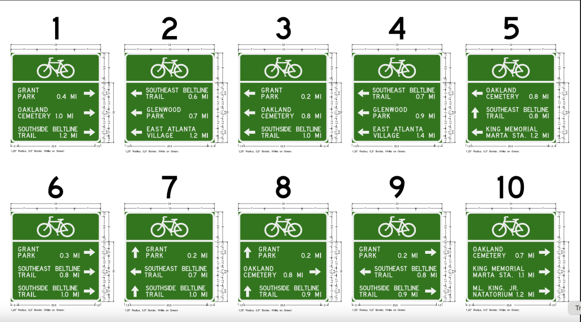 Example of multiple wayfinding additions planned along and near the Complete Streets route. ATLDOT; designs, Gresham Smith; Platinum Geomatics
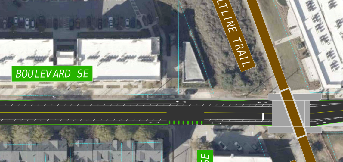
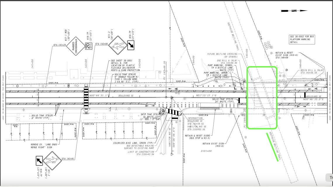 Finalized designs for how the South Boulevard Safe Street project will meet the Beltline's completed Southside Trail. ATLDOT; designs, Gresham Smith; Platinum Geomatics
Along with the Beltline’s Southside Trail, other points of interest along the route include Zoo Atlanta, Grant Park (Atlanta’s oldest greenspace), Boulevard Crossing Park, Red’s Beer Garden, El Progresso #14 (aka, Prison Tacos), and numerous other businesses.
The changes are also designed to help make Boulevard safer for Grant Park visitors on foot and kids walking to area schools, as Propel ATL officials have noted.
Localized efforts to change Boulevard began to bear fruit in 2017, back when neighbors succeeded in convincing city officials to extend the Monroe Drive/Boulevard Complete Street project farther south.
City leaders officially proposed the “South Boulevard Complete Streets” in 2021, and years of community engagement, meetings, and an open house followed, leading up to a ceremonial “groundbreaking” in November.
Find more context and a closer look at finalized designs for the South Boulevard Safe Street project in the gallery above.
...
Follow us on social media:
Twitter / Facebook/and now: Instagram
• Grant Park news, discussion (Urbanize Atlanta)