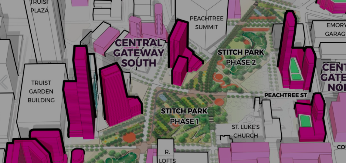
Downtown Atlanta’s grand plan to reconnect neighborhoods by constructing greenspace atop freeway lanes is now spelled out in more detail than ever before.
Eight years after Central Atlanta Progress initially unveiled its ambitious Stitch proposal, the highway-capping park project has officially made public its draft master plan—as detailed across nearly 1,000 pages of historical context, site analysis, phased plans, and enough visuals to make an urbanist wonk’s head spin.
Project spearheads Central Atlanta Progress and Atlanta Downtown Improvement District say the tentative master plan is the result of 18 months of work and input from more than 6,000 stakeholders. It lays out a roadmap for three phases of the Stitch park project, including land-use policies, key development sites (to include affordable housing), and both short and long-term transportation upgrades.
The Draft Stitch Master Plan’s daunting 927 pages is laid out in a way that’s actually fairly easy to consume. “A community equity lens was applied to each focus area,” notes a CAP and ADID summary, “to drive an approach that is inclusive of different community members.”
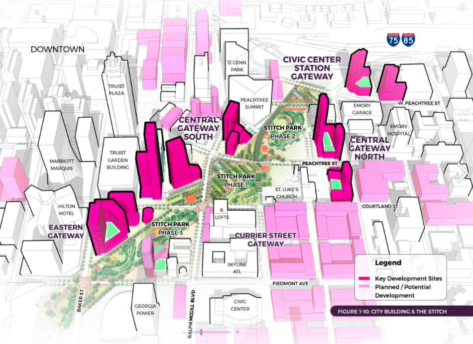 Overview of the three-phase Stitch proposal and potential related development sites. The area has the capacity to handle 16,000 new housing units at a variety of income levels, project leaders have said. Courtesy of Atlanta Downtown Improvement District
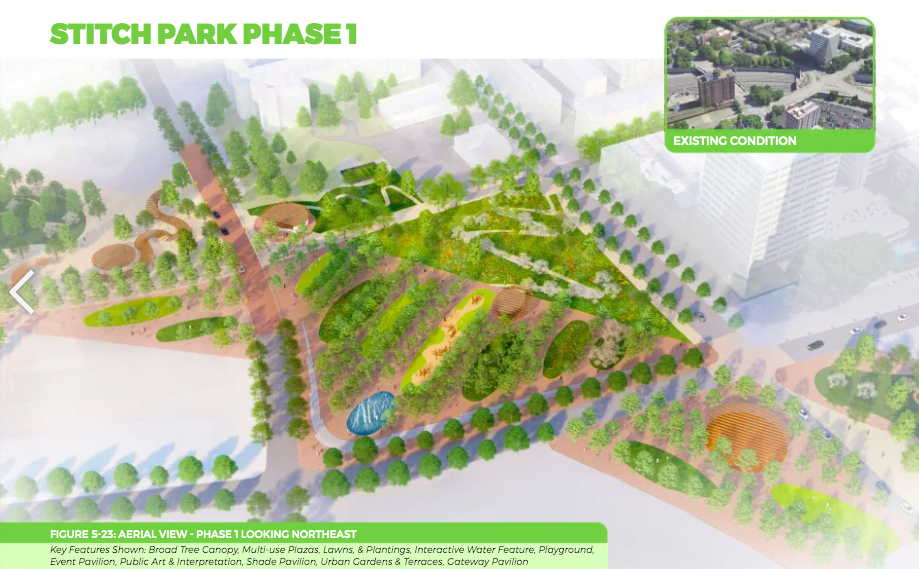
Stitch’s initial phase (now envisioned as 5.7 acres) has secured about $200 million needed to build it, mostly from a federal Reconnecting Communities and Neighborhoods grant. That calls for capping the highway between Peachtree and Courtland streets and upgrading connections to existing street corridors.
The master plan will be considered a draft document unit it’s adopted by the Atlanta City Council. According to project leaders, that’s expected to happen sometime in spring next year.
But first, CAP and ADID officials will be accepting public commentary on the draft master plan until Feb. 28. Instructions for commenting can be found at the bottom of this page.
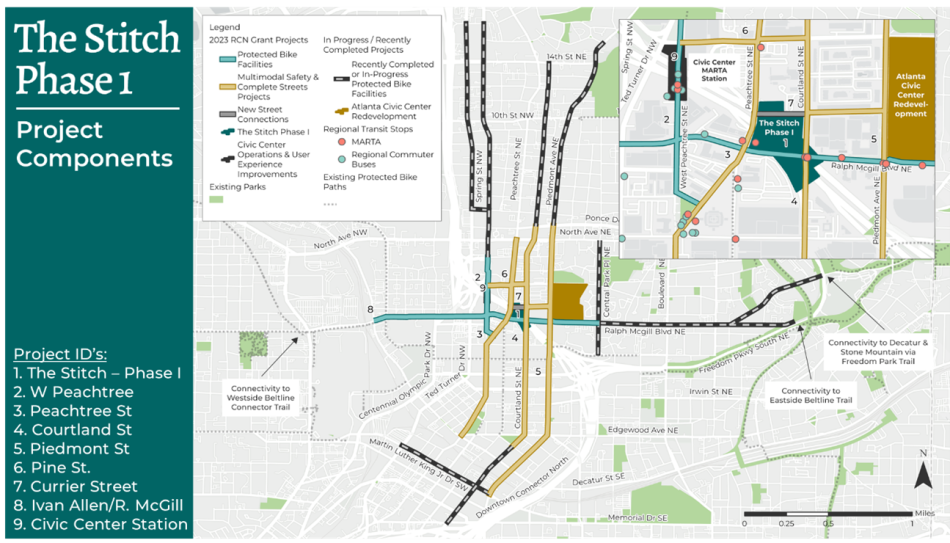 Planned connectivity for the Stitch's first phase. Courtesy of Atlanta Downtown Improvement District
Project leaders are predicting 2025 will be a “big year” for the Stitch proposal overall, with phase one designs ongoing and public meetings and presentations in the works to discuss those design choices.
Construction on the initial phase is scheduled to begin sometime in 2026.
The first phase is envisioned as the green heart of the project, with pathways, native gardens, a plaza, shade structures, pavilions, a playground, restrooms, and other features where a gash in downtown’s urban landscape exists today.
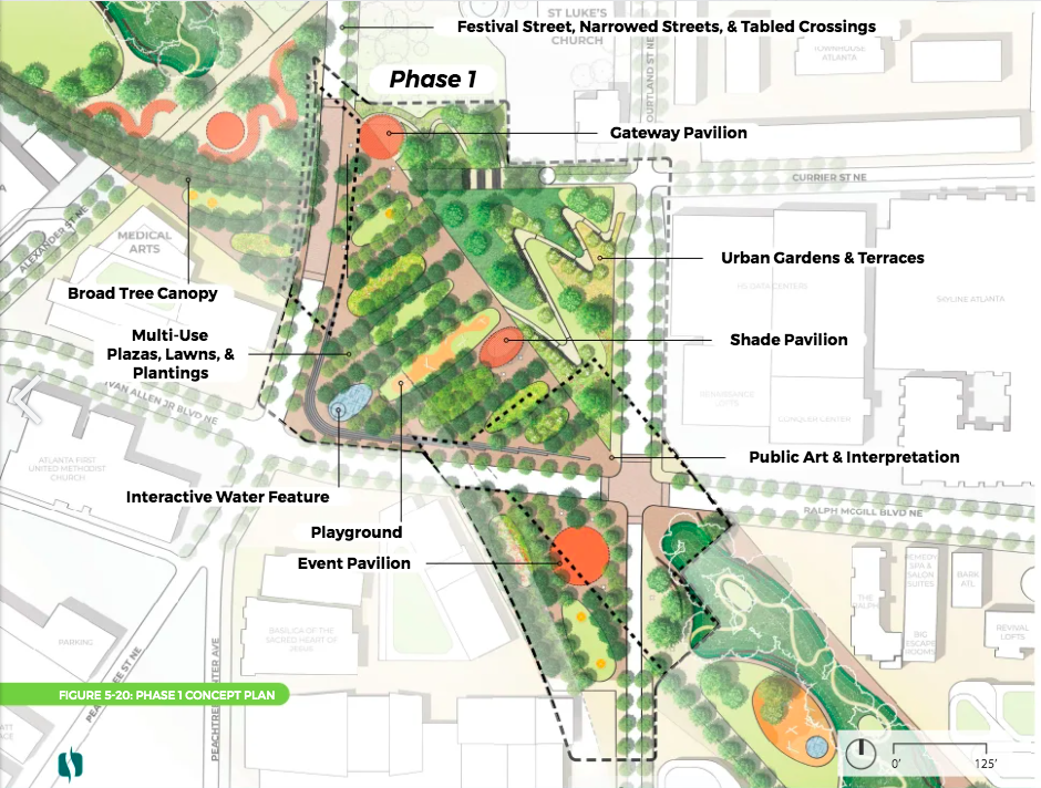 Components of phase 1, as currently planned. Project leaders' schedule calls for breaking ground on this section in 2026. Courtesy of Atlanta Downtown Improvement District
Phases two and three, tentatively scheduled to begin construction in 2029 and 2033, respectively, will require a variety of additional funding sources. Those could include state and federal grants, commitments from the City of Atlanta, philanthropy, and “real estate value capture,” according to project leaders.
Current projections call for 14 acres of new public space being created over the downtown Connector—finishing in roughly 12 years, or sometime in 2036, pending funding.
Another highway-capping proposal, the Connector Park concept in Midtown, officially bowed out of the running for local, federal, and philanthropic funding in July. Meanwhile, design and fundraising work for Buckhead’s highway-topping HUB404 project is ongoing.
...
Follow us on social media:
Twitter / Facebook/and now: Instagram
• Downtown news, discussion (Urbanize Atlanta)


