Move over, Chattahoochee—and meet the Atlanta River.
Okay, not really. But a time-honored Atlanta tradition is to imagine various canker sores of urban topography flooded with billions of gallons of water, including the Gulch, Bellwood Quarry (well, that happened), and occasionally the Downtown Connector.
But never before has the dream been rendered so vividly as this.
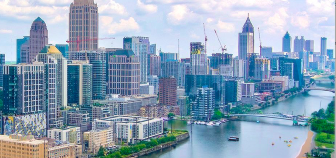
Using an Urbanize Atlanta aerial photo from over Atlantic Station, and another pic by WSB airborne traffic reporter Mark McKay, an urban designer named Stone Ray this week compiled images replacing the Connector with a serpentine body of water, and he asked: “What if Interstate 75/85 were a river?”
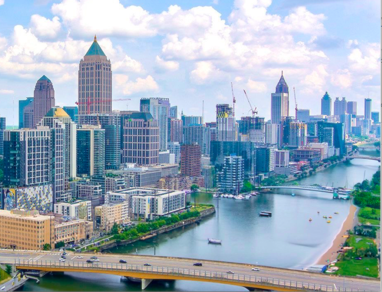 Imagine a Midtown recreational paradise instead of 16 traffic lanes. Stone Ray/@stoneray; original image, Urbanize Atlanta
Ray (@stoneray) works for Birmingham planning and redevelopment advisory firm Orchestra Partners. He tells Urbanize Atlanta these mind-boggling renditions of the waterlogged Connector took just a few minutes to compile in Photoshop. (We've offered many more aerials for him to work his magic on, when time allows.)
The images paint a picture of what the ATL would look like if, like most major cities, it was actually founded on a major river. Or if we decided one day to make drivers take I-285 instead and flooded Midtown/downtown’s giant freeway—which at one point swells to 16 traffic lanes—with glorious recreational opportunities.
Cannonball off the 17th Street bridge anybody?
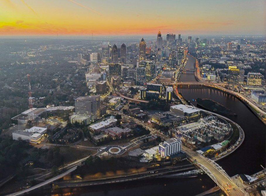 A lovely sunrise over Atlanta River. Stone Ray/@stoneray; original image, Mark McKay/WSB
...
Follow us on social media:
Twitter / Facebook/and now: Instagram
• Midtown news, discussion (Urbanize Atlanta)