What do descriptions like “structurally unsound,” “serious damage,” and “some defects” have in common?
They all refer to properties highlighted on a new Geographical Information System tool launched by DeKalb County and Decide DeKalb to help developers pinpoint blighted or underused sites that could be ripe for redevelopment—with cash incentives included.
The layered GIS map is designed to bring brownfield sites to light in a digestible, one-stop-shop way, with pertinent details such as ownership and type of potential hazard listed for hundreds of properties.
Geographically, spotlighted properties—including those within the City of Atlanta—span from East Atlanta Village and the fringes of Northlake Mall to Covington Highway and the shadow of Stone Mountain. Empty lots, former gas stations, abandoned buildings, and even a shuttered, famous burger joint are included.
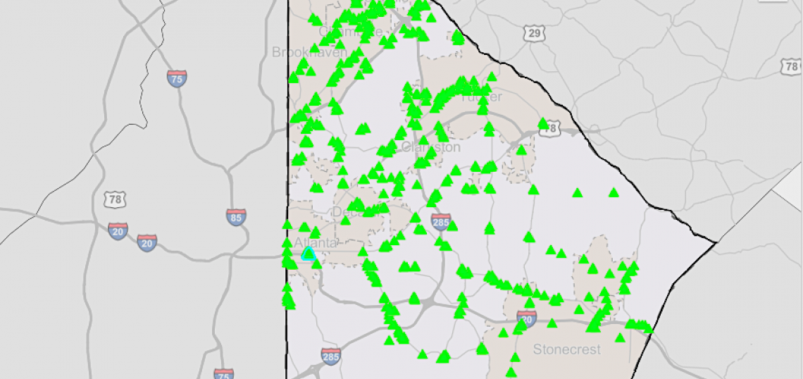
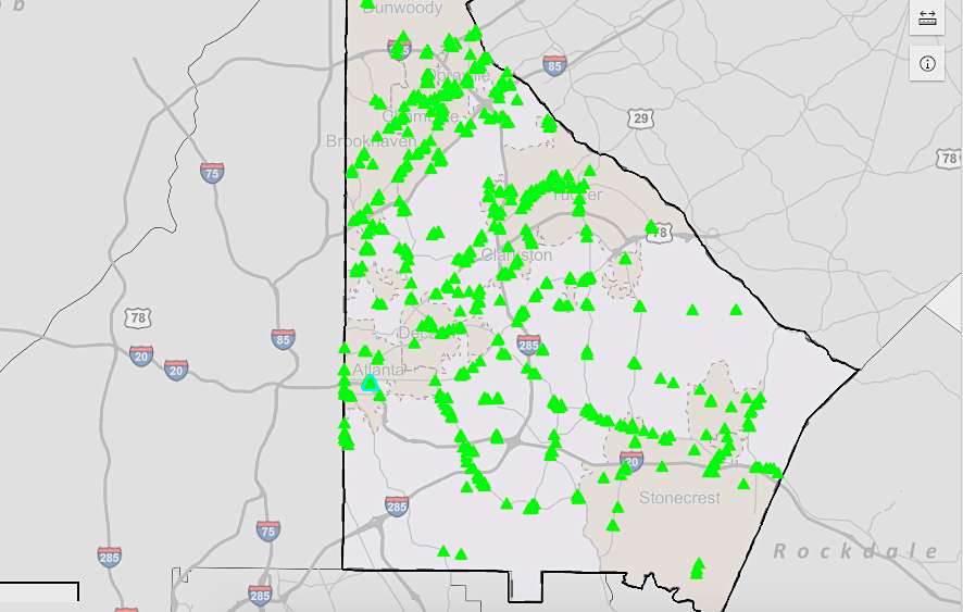 Overview of sites currently listed on the DeKalb Development Opportunity Sites Inventory/Brownfields Viewer.Courtesy of DeKalb County
Brownfields are commercial or old industrial sites impacted by environmental contamination, but not all sites on DeKalb’s GIS page need remediation, per the mapping tool.
As compiled by Cardno Infrastructure GIS & Asset Management group, the new database is a collaborative effort between economic development authority Decide DeKalb and county commissioner Robert Patrick, who allocated $30,000 for the GIS tool from Commission District 1 funds.
The goal, per the county, is to transform brownfield properties from “blight to bright.”
Developers can potentially qualify for funding to help clean up sites, and Decide DeKalb has committed resources to help research the availably of such funds, according to county reps.
Have a gander— rabbit hole alert!—at the new GIS tool here. And please speak up if anything stands out as particularly interesting.
...
Follow us on social media:
• Decatur officially adopts new slogan, 'Like Atlanta, Only Better' (Urbanize Atlanta)