An analysis that could be the first step toward transforming mobility options across huge sections of Atlanta is making progress. Project leaders are now seeking public input to help determine where it goes next.
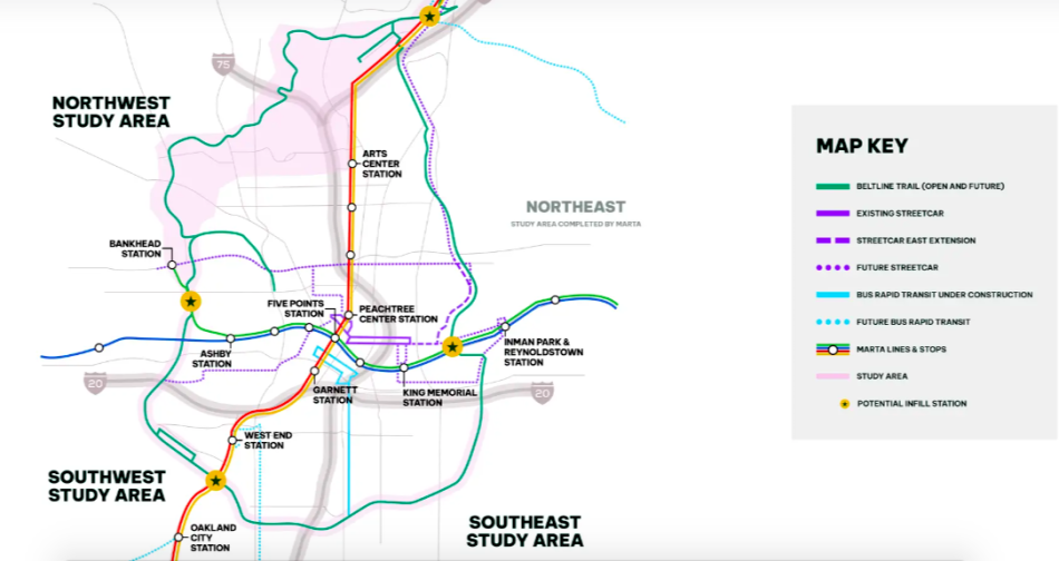
Atlanta Beltline Inc. kicked off the Beltline Transit Study in September 2023 to analyze the potential future of mobility around all sections of the 22-mile loop, excluding the northeast quadrant from Old Fourth Ward up to the Lindbergh area, where MARTA is conducting its own transit study.
Alongside a consultant team lead by Kimley-Horn, the Beltline has wrapped the study’s first phase. It pinpoints where transit routes could go—and where up to 21 stops could be located—but it doesn’t specify which mode of transportation would be used.
That’s where the general public’s input comes in.
The Beltline Transit Study survey will be available online until Dec. 1 as a means of gathering 2 cents from Atlantans with an interest in the Beltline’s transit future. (Our test-run took seven minutes total.) It’s a chance for Beltline users to share thoughts on transit alignments, station locations, and routes, and to input data on Beltline usage today, and future transportation and travel modes.
“By participating in the survey,” officials note, “you'll play a key role in helping the Beltline shape the future of Atlanta’s transit.”
The study focuses on corridors broken down into northwest, southwest, and southeast, and it aims to reflect the needs and future transit use that’s unique to each part of town.
Clockwise, the 13 total miles analyzed span from Glenwood Park, just south of Interstate 20 on the eastside, around to Bankhead and up into Buckhead near MARTA’s Lindbergh Center station.
For the southeast section, stretching from Glenwood Park around to West End, 14 stations initially proposed have been whittled down to seven.
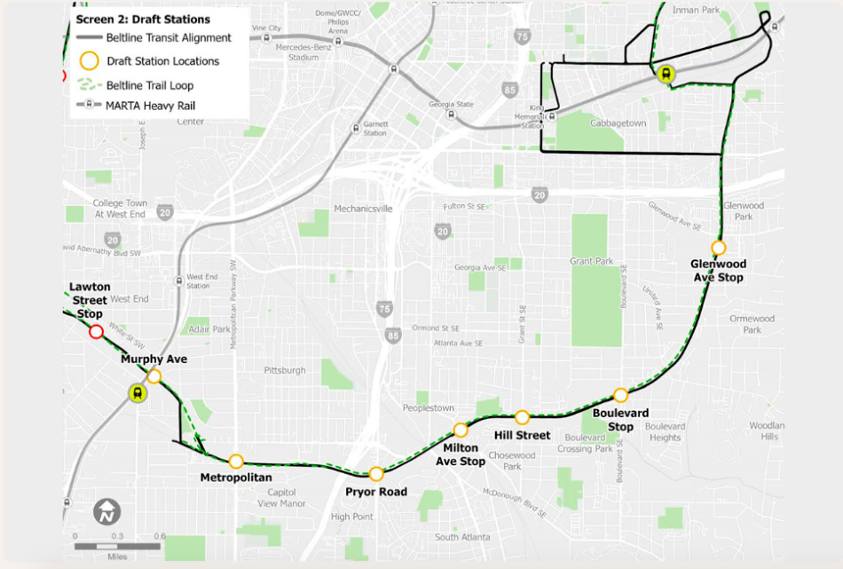 Where current, tentative plans call for seven stations to be placed in the southeast corridor. Atlanta BeltLine Inc.
In the southwest quadrant, analysts have recommended that six stations move forward, dotted from near the Lee + White mixed-use district up to Donald Lee Hollowell Parkway.
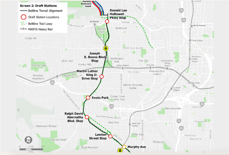 The six draft station locations planners have recommended to move forward in the study's southwest quadrant.Atlanta BeltLine Inc.
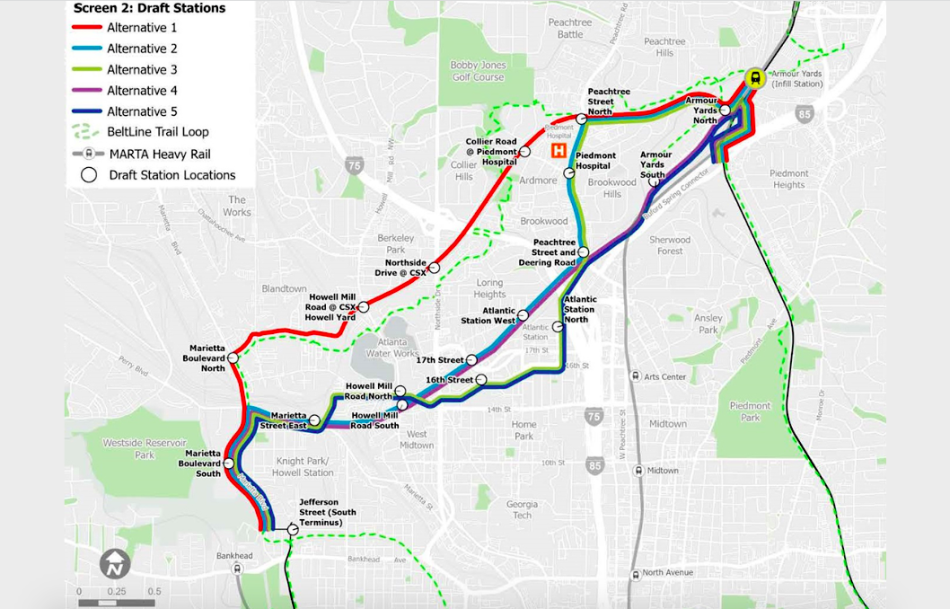
Lastly, the northwest quadrant is trickiest. That’s where a transit route will have to weave through residential districts without use of a former rail corridor, like the Beltline trail itself in the area.
Analysts have narrowed down 18 potential routes for that corridor to five alternatives. Four of those would link to Atlantic Station, while one would remain farther north.
“Each alignment,” Beltline planners note, “has the potential to connect to the proposed MARTA infill station at Armour Yards or, if necessary, reach the Lindbergh Center MARTA station.”
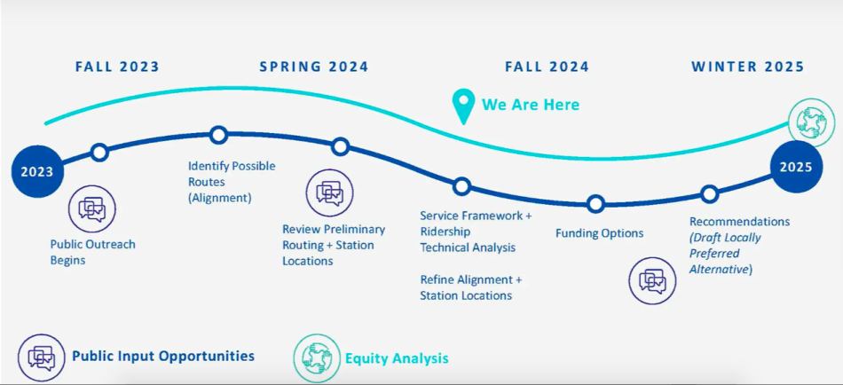
According to the latest study timeline, funding options for transit routes will be explored next year, and all work including financial planning and ridership forecasting is expected to wrap by late 2025.
Beltline officials will use engineers’ and public input to reveal a Locally Preferred Alternative at that time.
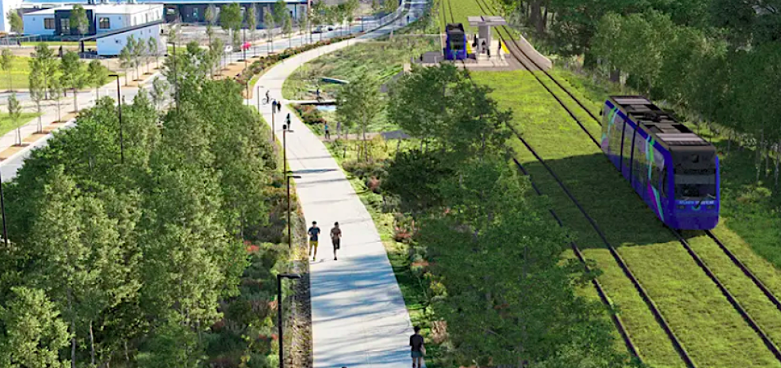
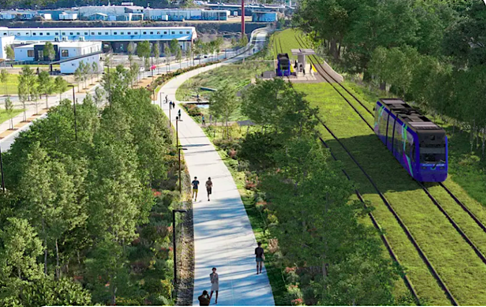 Light-rail operations and potential look of a stop shown near Pittsburgh Yards on the Southside Trail. Atlanta BeltLine Inc.
...
Follow us on social media:
Twitter / Facebook/and now: Instagram
• Mayor unveils plan to spur affordable housing in high-growth areas (Urbanize Atlanta)


