Earlier this month, during the headline-grabbing groundbreaking and hullabaloo for Atlanta’s first bike park, a common question came in through the inboxes and social media channels. To paraphrase: This $9-million city amenity looks promising, but how will we get there from the Beltline?
Two months prior, during an Atlanta Beltline Inc. update meeting on the 45-acre bike park’s progress, planning officials were asked if a bridge into the city’s largest greenspace—Shirley C. Franklin Park (formerly Westside Park), where the bike park is being built—might come to fruition. Meghan Injaychock, the Beltline’s senior landscape architect and project manager, replied: “We always get this question,” before directing the inquiry to the Upper Westside Community Improvement District, a local entity working to improve connectivity that, per Injaychock, has made the most planning progress on better routes into the park to date.
The issue: The Beltline’s Westside Trail, a miles-long vein of off-street connectivity, was completed last summer. Shirley C. Franklin Park, now growing again, is spread across 280 acres. At points, the distance between the two is less than a city block—if not just a few yards. But in between is a significant barrier: an active CSX railroad line. And railroad companies are rarely, truly motivated to be good urbanists.
As it stands, accessing the park from the Beltline requires a meandering detour along busy streets (if not in them) that can add miles to trips by bike, scooter, or foot. The route from the north, West Marietta Street, lacks sidewalks in places and can feel flat-out dangerous on two wheels.
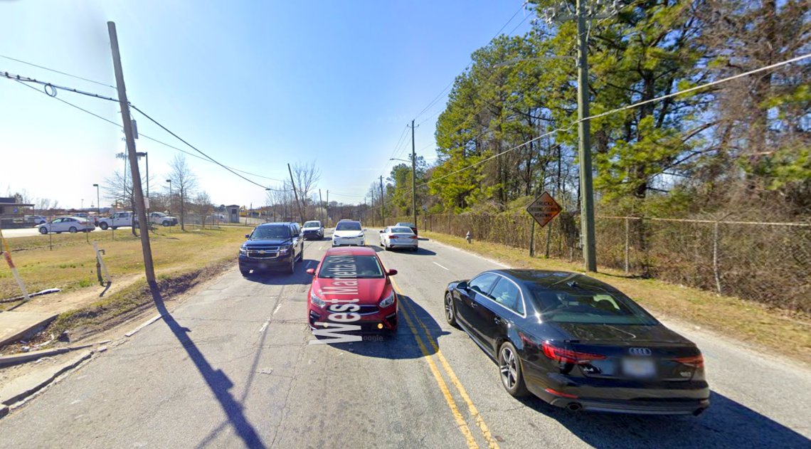 Just off the Beltline, headed toward main park entrances, the West Marietta Street corridor looks like this. Google Maps
So what’s being done right now to make the sprawling, beautiful park the Beltline-connected necklace emerald it was always fundamentally supposed to be?
The short answer: Not much. At least not yet.
But three viable scenarios do exist. Here’s where they stand:
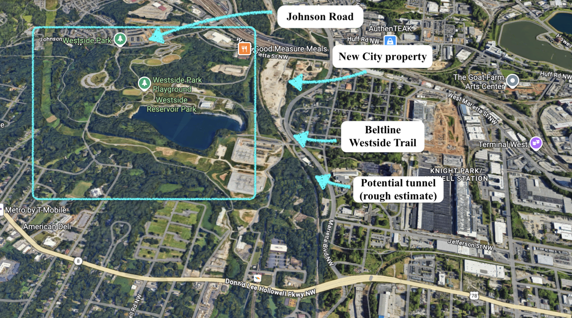 Scope of the 280-acre Westside greenspace and potential future access points from the completed Beltline. Google Maps/UA
On-street route from Beltline to giant park
Back in the summer of 2024, Upper Westside CID and city officials announced a significant win for beefing up transportation, bicycling, and pedestrian infrastructure between Georgia Tech and Atlanta’s largest park: a $16-million federal RAISE grant—that’s Rebuilding American Infrastructure with Sustainability and Equity—that would fund a multimodal project called Westside Thrive.
Spanning roughly three miles, Westside Thrive calls for retrofitting dangerous roads, building bike and pedestrian infrastructure, and improving transit stops.
The initiative also received a $6.9-million local match from the city’s Moving Atlanta Forward infrastructure program, bumping the total allotted budget to $22.9 million.
On the docket for upgrades was one direct route into the park from the Beltline: West Marietta Street to Johnson Road. The allotted funding was sufficient to cover design and construction, according to Elizabeth Hollister, Upper Westside CID executive director. But since 2024, on many levels, things have changed.
“Our grant agreement, like many others, has been held up in the current federal administration’s reviews,” Hollister wrote to Urbanize Atlanta via email last month.
On the bright side, she offered to send an update “whenever we have the green light to get started.”
Wait—a tunnel?
If you’ve branched out of downtown on the Westside Beltline Connector trail, taken a sharp right at the CSX railroad tracks, and found yourself headed north along Marietta Boulevard on the Beltline … well, try to imagine taking another left there and finding a tunnel into the park.
According to Greta deMayo, PATH Foundation executive director, a tunnel linking the Westside Trail to the park—dubbed the “Jefferson Greenway”—is a viable possibility.
The tunnel would burrow under active railroad lines south of the Fulton County Animal Services shelter at 860 Marietta Boulevard, per deMayo.
That scenario is laid out in the City of Atlanta’s extensive Trails ATL masterplan under what’s called phase three of implementation. But no potential ETA is currently available.
That document does point to another possibility for bringing Beltline patrons into the park.
Public-private development project
As the COVID-19 pandemic ebbed, just north of the aforementioned animal shelter, New City Properties—the company behind the $1-billion Fourth Ward Project and 725 Ponce, both Eastside Trail landmarks—scooped up 18.8 vacant acres formerly home to a concrete recycling plant.
That was the spring of 2021, when Microsoft’s massive campus was still expected to neighbor the park.
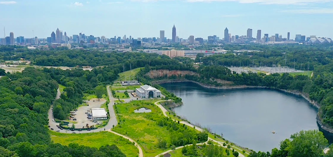
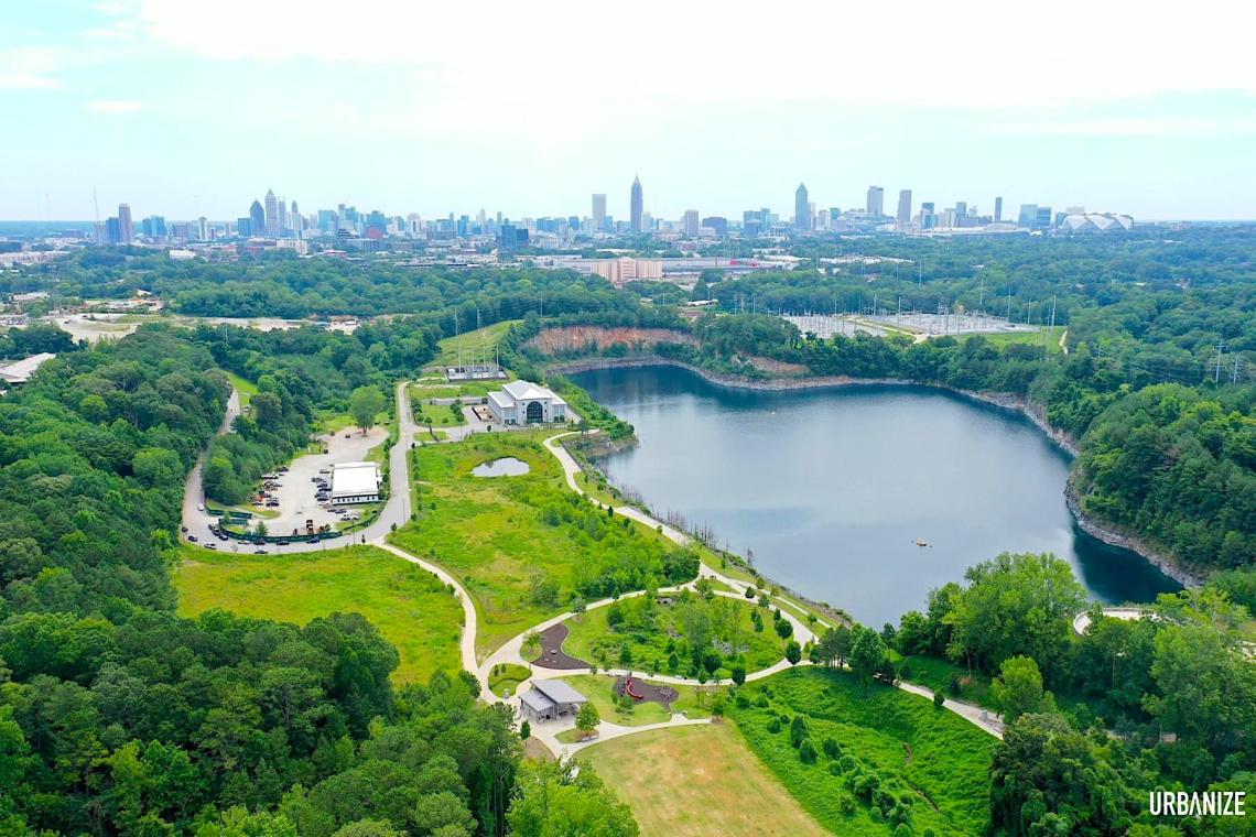 Aerial image showing one section of Shirley Clark Franklin Park in June, looking east toward Midtown and downtown.
New City president Jim Irwin tells Urbanize Atlanta that, despite the property’s front-row proximity to both the Westside Trail and park in a growing part of town, current economic conditions have rendered the site’s redevelopment work idle for now, apart from some initial planning. But he’s aware the Beltline and city officials view his sizable land holding as prime real estate for park connectivity.
At this point, Irwin balks at discussing what that connection could look like, in order to avoid committing to concepts that could change. He envisions the site, already rezoned MRC-3 for high-density mixed uses, springing to life as multiple housing types, office spaces, and retail. Eventually.
“Finding a way to connect the Westside Beltline through the property to the park is a high priority,” Irwin said this week. “A lot of people are working on it, and that’s why I love this particular piece of property—it’s at the nexus of all these efforts.”
...
Follow us on social media:
Twitter / Facebook/and now: Instagram
• Grove Park news, discussion (Urbanize Atlanta)