For generations to come, the final major section of PATH400 to be built could be a literal high point among metro Atlanta’s growing network of multi-use trails and scenic greenways.
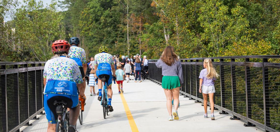
PATH400 spearheads Livable Buckhead and city officials on Friday cut the ribbon on a highly anticipated section of the trail project that includes a towering Mountain Way Common bridge, perched 80 feet off the ground among treetops.
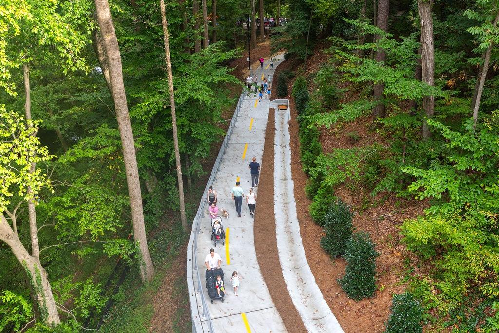
The latest .75-mile PATH400 segment—running between Wieuca Road up to Loridans Drive, north of central Buckhead—creates almost three miles of contiguous greenway, boosting bike and pedestrian connectivity in Atlanta’s northern fringes.
 Entry to the new 80-foot-high PATH400 bridge is shown in the background. Courtesy of Livable Buckhead
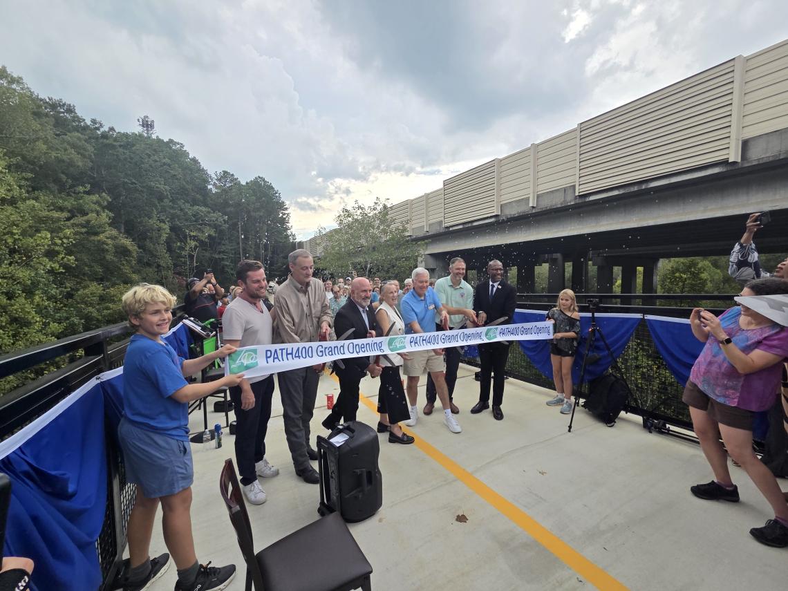 Denise Starling, Livable Buckhead executive director (center, in white), helps lead Friday's ribbon-cutting atop the new PATH400 Bridge. Courtesy of Livable Buckhead
A community festival, bike parade, and remarks from dignitaries marked the official end of the newest PATH400 section’s three-year construction period.
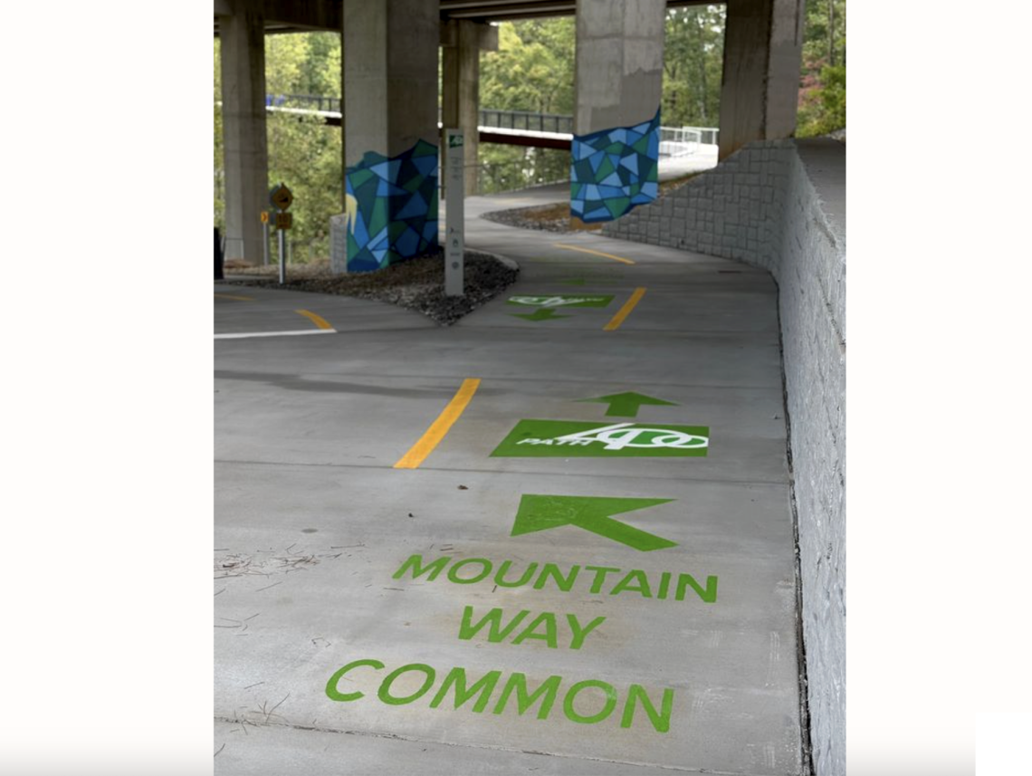
Denise Starling, Livable Buckhead executive director, said the latest segment and treetop bridge will provide a safer walk to school for Sarah Smith Elementary students and a front door to the growing Mountain Way Common greenspace.
“This is one of those moments where you stop, look around, and say, ‘Wow! We actually pulled it off,’” said Starling in a Friday statement. “PATH400 has always been about connecting people—to their schools, their parks, their neighborhoods, and to each other—and today we quite literally connected the dots.”
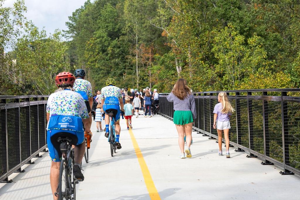 Protective fencing on both sides of the new bridge was enhanced during construction for greater safety. Courtesy of Livable Buckhead
 Courtesy of Livable Buckhead
When finished, PATH400 will be a 5.2-mile trail system built on public land next to Ga. Highway 400, extending from Peachtree Creek’s banks, around Lenox Square, and up to the northern edge of Atlanta. A connection is planned to the Beltline’s Northeast Trail and two other trail networks in the Lindbergh area: the Peachtree Creek Greenway and Southfork Conservancy trails. Planning work continues in those areas.
The latest PATH400 segment includes nearly 500 newly planted native trees and is expected to boost local property values, according to Livable Buckhead.
The $13.4-million project was paid for with federal transportation improvement project funds administered by the Atlanta Regional Commission, City of Atlanta TSPLOST funds, and funding for design from Buckhead Community Improvement District.
PATH Foundation provided construction management services, and the Georgia Department of Transportation provided its right-of-way along Ga. Highway 400, as with most sections of the greenway.
North of the new bridge, the final unfinished PATH400 segment between Loridans Drive and the city limits of Atlanta/Sandy Springs is also under construction now.
Beyond that, heading north, a 2.3-mile extension that would bring the Sandy Springs pathway up to the Interstate 285 and Ga. Highway 400 interchange is now fully funded with an $18 million grant from Atlanta Regional Commission.
 Guardrails being made studier than earlier plans had called for, as seen in fall 2024. PATH400; via Livable Buckhead
 The Mountain Way Common bridge built by C.W. Matthews Contracting Company, as seen last fall. PATH400; via Livable Buckhead
Along with Starling, officials who helped lead Friday’s ribbon-cutting included Pete Pelligrini of the PATH Foundation; Atlanta City Councilmember Howard Shook; Justin Cutler, City of Atlanta Department of Parks and Recreation commissioner; and Solomon Caviness, City of Atlanta Department of Transportation commissioner.
Pedal up to the gallery for a closer look at PATH400’s newest outdoor offerings.
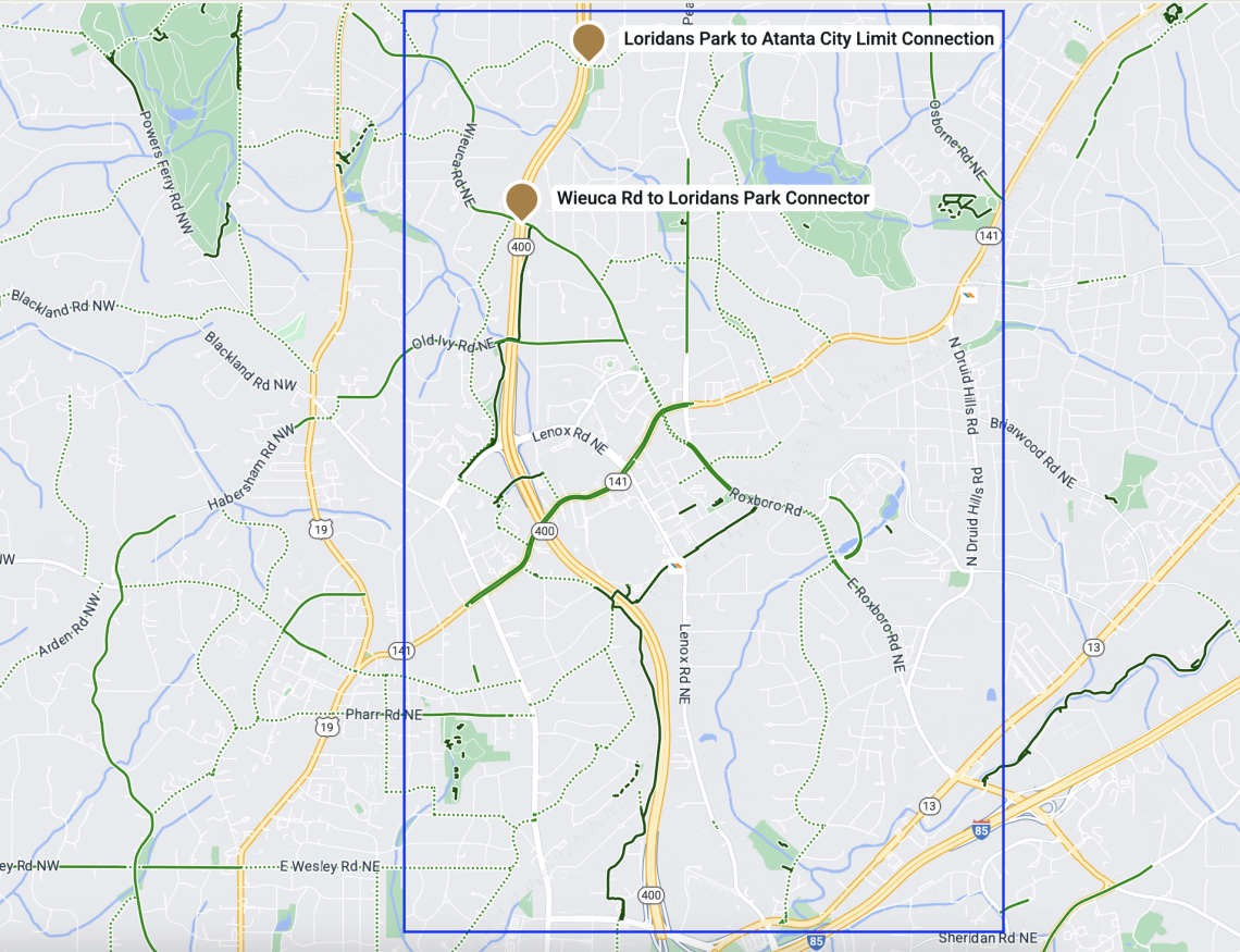 Scope of finished PATH400 sections today and the northernmost section that's now open. Livable Buckhead/PATH400
...
Follow us on social media:
Twitter / Facebook/and now: Instagram
• Buckhead news, discussion (Urbanize Atlanta)