Over the past year, much has been written about the wave of more than a dozen restaurant closures that’s plagued the area generally considered West Midtown.
Alongside traffic congestion, parking—be it a lack thereof, or the high cost to do so—is consistently cited as a main culprit in an area lacking the alternate-transportation infrastructure, such as MARTA rail and mainline Beltline trails, enjoyed by other parts of town.
In response, community leaders have devised a solution that could make hardcore urbanists shudder: making parking simpler and cheaper.
The Upper Westside Community Improvement District, a local government entity covering six neighborhoods, has launched an interactive parking map function on its website that’s designed to make the growing district more accessible and convenient, officials announced today.
The map breaks down how much parking costs (or how long it’s free/validated) at specific structure locations from The Works district down to blocks south of The Optimist, with a heavy emphasis on the Marietta Street Artery neighborhood.
It also notes if EV chargers and bike racks are available.
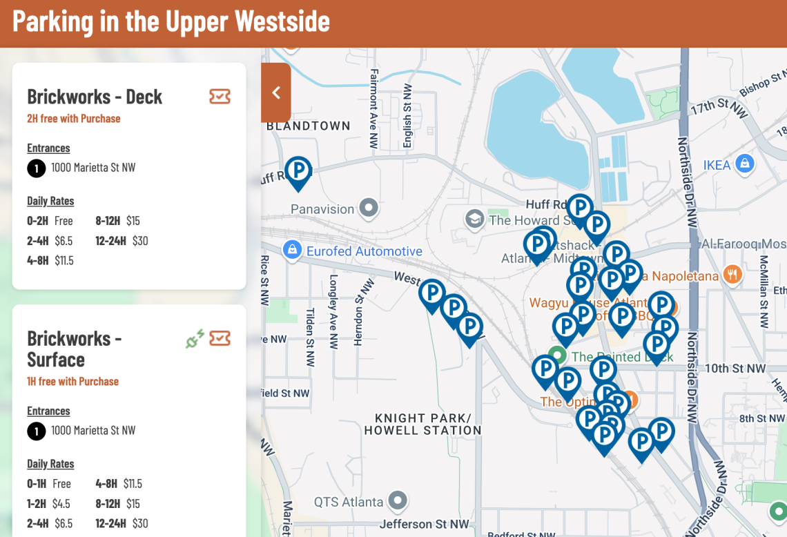 Look and functionality of Upper Westside Community Improvement District's new interactive parking map. Upperwestsideatl.org
Two-hour parking rates north of $10 are still common in the area, but local property owners have included reduced parking rates and more parking validations as part of efforts to spur more visitors, according to Upper Westside CID officials.
Beyond the online tool, CID leaders and some property owners have deployed way-finding Upper Westside signage to help lead drivers to parking decks and rideshare drivers to safe, convenient drop-off and pick-up zones. Other signs point to bicycle parking in the area.
“The new map takes the guesswork out of parking costs, so planning visits to enjoy everything our shops and restaurants have to offer is effortless,” said Matt Bronfman, Jamestown CEO and part-owner of Westside Provisions District, in today's announcement.
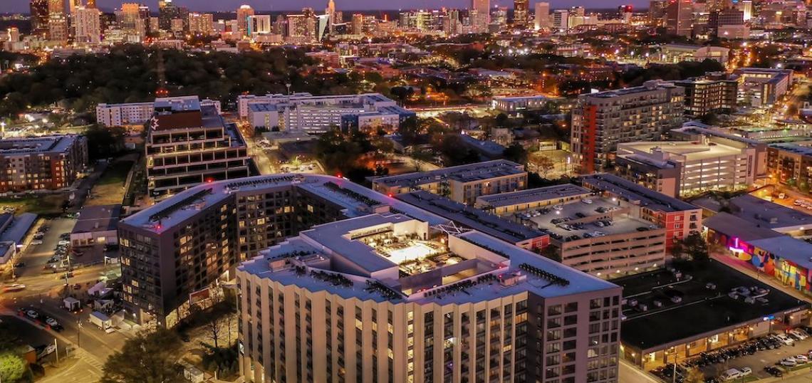
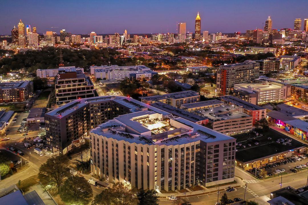 The view across the Star Metals District and Georgia Tech to Midtown and downtown. Photography by Jeremiah Cowan; courtesy of Oppenheim Architecture
Efforts to boost the area’s multimodal accessibility, such as the Howell Mill Complete Street project, are underway, but CID officials acknowledge that many trips to and from the district’s neighborhoods are still made by car.
“The interactive parking map reflects the collaborative spirit of the Westside,” noted Adeline Collot, Upper Westside CID’s program director, in a statement. “We’re making it easier for people to discover, explore, and support this community.”
...
Follow us on social media:
Twitter / Facebook/and now: Instagram
• Marietta Street Artery news, discussion (Urbanize Atlanta)